
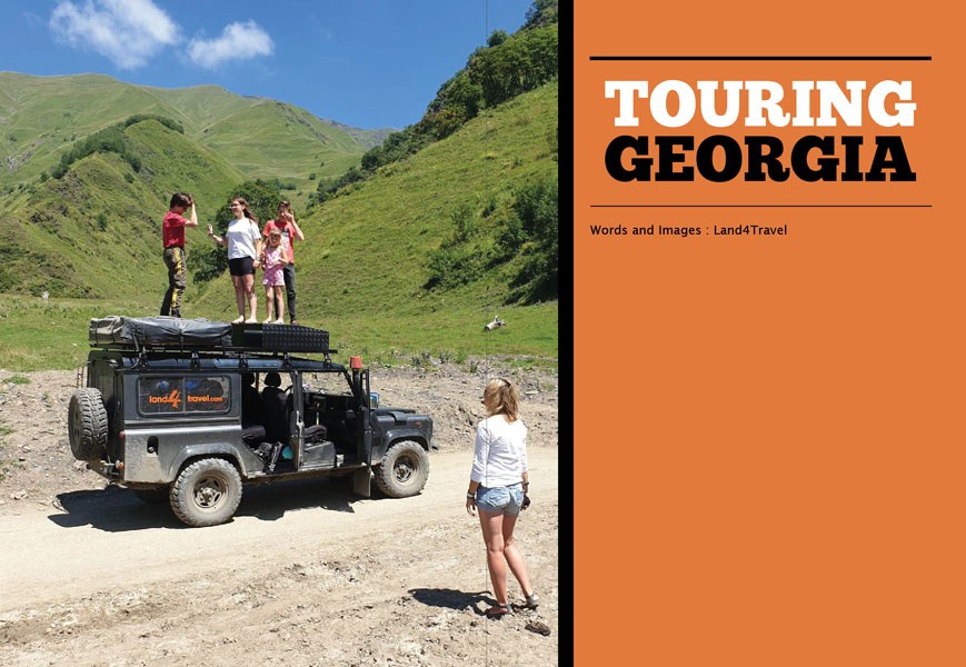
 Georgia is a popular tourist destination for good reason. The country has an extraordinary combination of breathtaking landscapes, friendly people and a wonderful and fascinating culture. The combination of Western standards with a typically Eastern approach to life is evident here. And every region in Georgia has its own unique aspects that are worth experiencing.
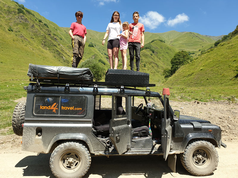
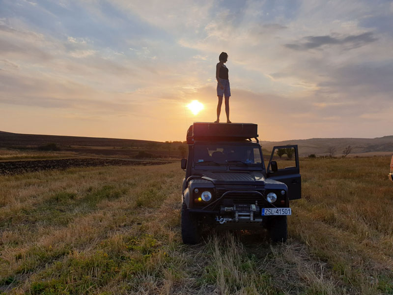
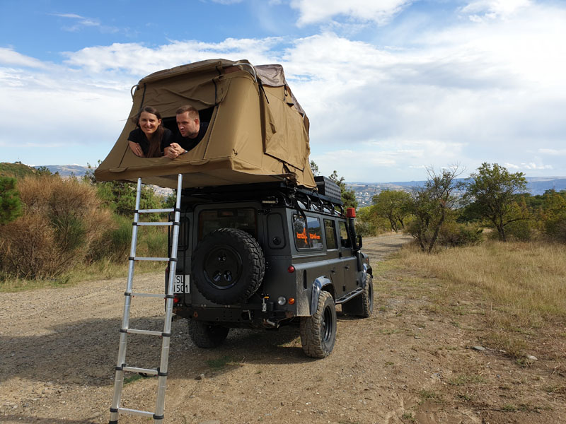
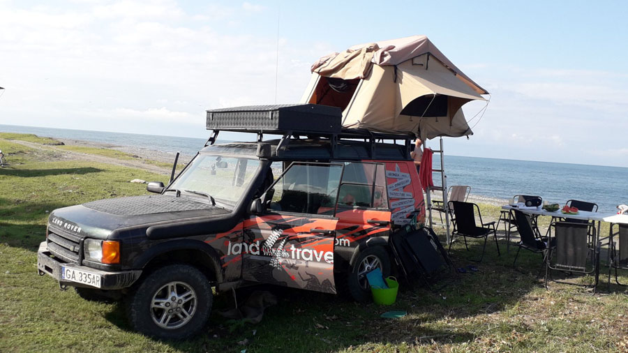
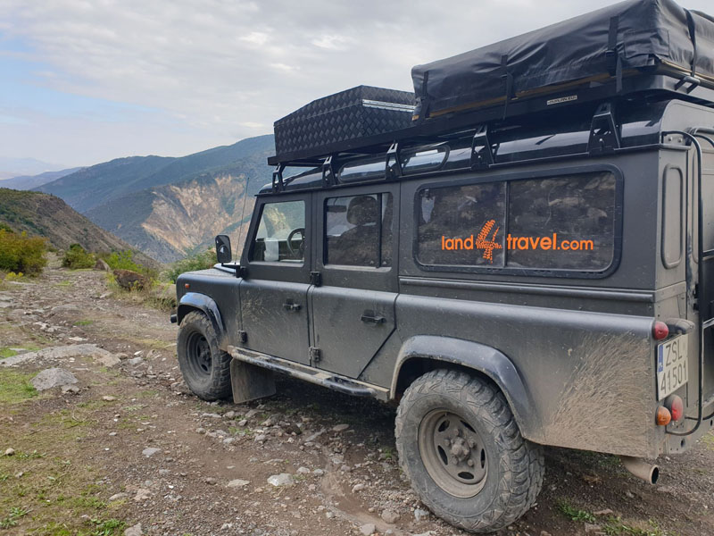
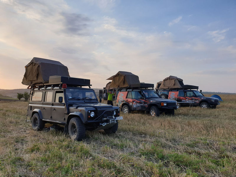
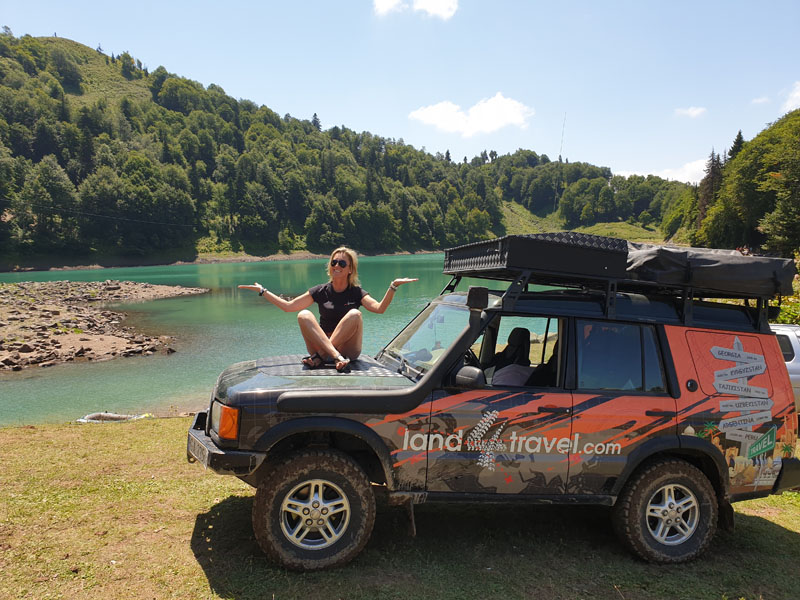
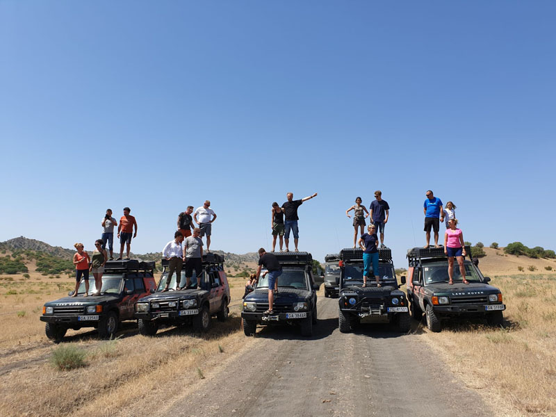
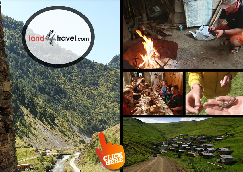
We start our Georgian adventure at the airport in Tbilisi, where expedition vehicles are waiting for us. There are several companies where you can rent such vehicles. If you are interested in renting 4×4 cars without a pass, but also without roof tents or other camping equipment, I recommend https://rent.martynazgruzji.pl/.If you would like to visit Georgia on expedition Land Rovers, under the guidance of experienced guides, then I recommend land4travel.com 😉
Udabno, Oasis Club
The first stop on our route is 70 km from Tbilisi Udabno, where the club run by Kinga and Xavier is located. It is an ideal place to rest after a hard day driving. Although it is 70km long, because we are driving off road – the journey takes 4 hours, and if it rains, some sections will be pretty difficult. Udabno is also a great starting point for Davit Gareja – a place whose omission from a tour of Georgia would be an unforgivable sin.
David Gareja is a complex of monastic buildings carved into the rock in the Kachetia region. Founded by 13 Syrian monks in the 4th century on the slopes of a mountain called Garedja. The first of the monks settling there was named David, hence the name of the whole complex. There are currently several monks living in the buildings, and the legal status of this place is unclear. David Gareja is right on the border between Georgia and Azerbaijan, and these countries are still in dispute over the ownership of the temple complex.
At the beginning of September, the Oodabno Festival takes place in Udabno, the festival features music from Polish and Georgian music bands, you can find more information on the festival on Facebook.
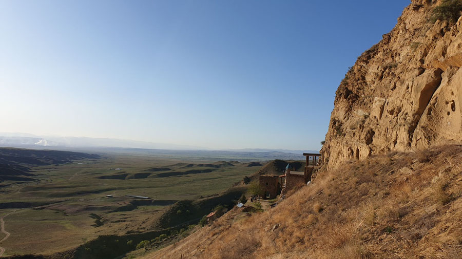
After two days in Udabno, it’s time to continue our journey. Our goal will be Dedoplisckaro, where the vashlovani National Park Directorate (41.462607, 46.103662) is located, where we will buy permits to enter the National Park. But before we get there, we will drive past some mud volcanoes (41.245649, 45.843757).
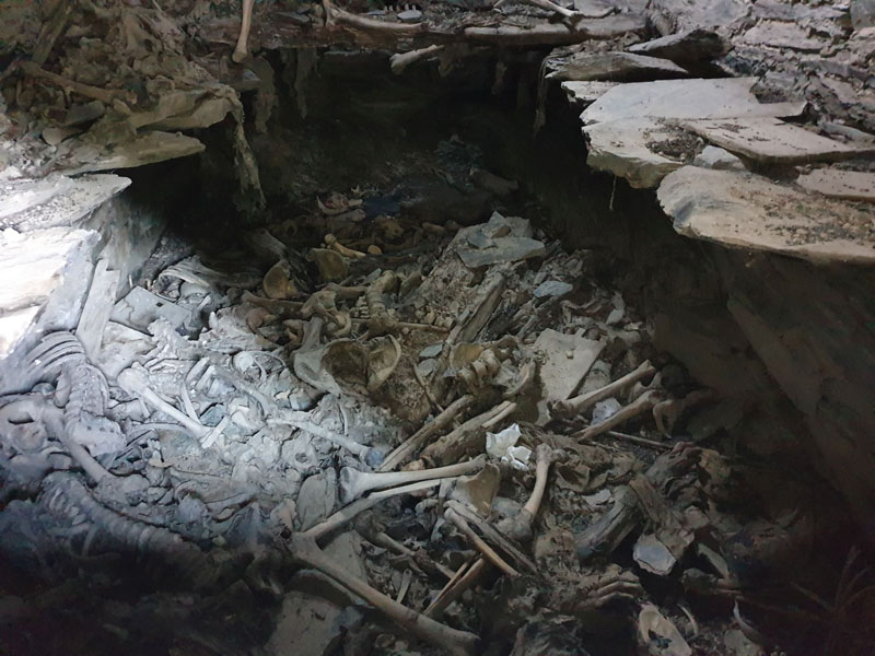
Graveyard near the road to Musto
Small volcanic cones grow among the hills and steppes of southeastern Kachetia. From time to time, cool water, gas and sometimes oil mixed with mud are expelled from them. When this spills onto the roads they will get boggy and slippery.
Arriving in the city, our first task is to visit the official park office, where we will buy entry tickets. After the necessary formalities have been completed, we camp on the banks of the Alazani River, which is basically the border between Georgia and Azerbaijan. Shopping at this point is important, because the next opportunity to restock will be 2 full days away. In Dedoplisckaro it is also important to refuel your vehicles and fully replenish your water supplies. In my opinion, Park Vashlovani is a hidden gem unknown by tourists. Not that I complain, on the contrary – This means that most likely for the next 3 days we will be alone or almost alone. Vashlovani is a paradise for offroad drivers – it is here that we will drive along the bed of a dried-up river, it is here that it will our hearts beat faster on steep climbs or descents, and it is here (as, in most of Georgia) that we can camp wherever we like as long as we are respectful and leave no trace.
Vashlovani National Park is located in the southernmost part of Georgia, right on the border with Azerbaijan. It is a desert and semi-desert area, inhabited by Anatolian leopards, striped hyenas, brown bears, wolves or lynx… Unfortunately, probably all wild animals will be hidden in the grass during our stay 😉
We camp in Mijnis Kure, just above the warm waters of the Alazani river, whose channel will separate us from Azerbaijan. The starry skies are also amazing, I have never seen so many stars anywhere else except in Africa.
After packing up our camp we head north towards the vast vineyards of fertile Kakheti region . Wines of the greatest depth and purest aromas – separavi, tsinandali or kindzmarauli -are produced here.
While in Kachetia, be sure to visit Kvareli, a town that boasts the country’s oldest wineries and a rock-hollow bunker that is now used to store wine. The tunnel is located about 2 km to the west of the town and it has a constant temperature of 14C – which is apparently the ideal temperature for storing wine. We have already identified our next place to camp – it will be an islet on Alazani, which we ford a river.
But before we get there we have to see one more place – the monastery of Nekresi, built on the picturesque slope of one of the high caucasus ranges, where every year during the feast of Nek’resoba (7.11.) it is customary to sacrifice a piglet
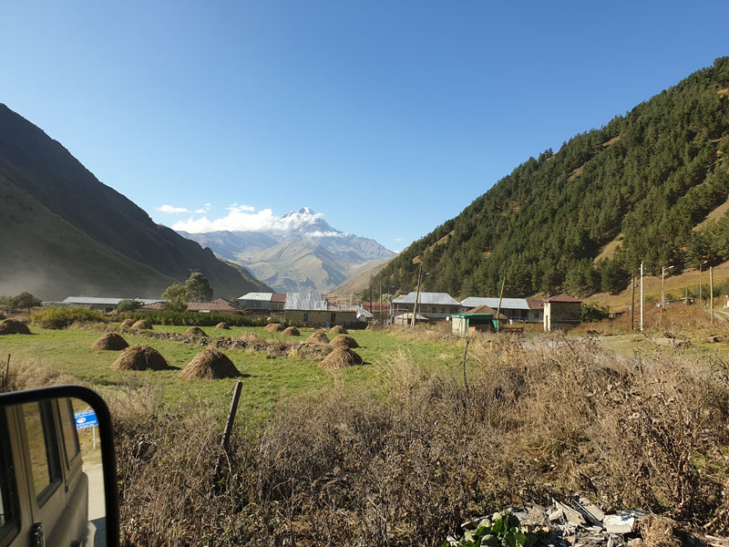
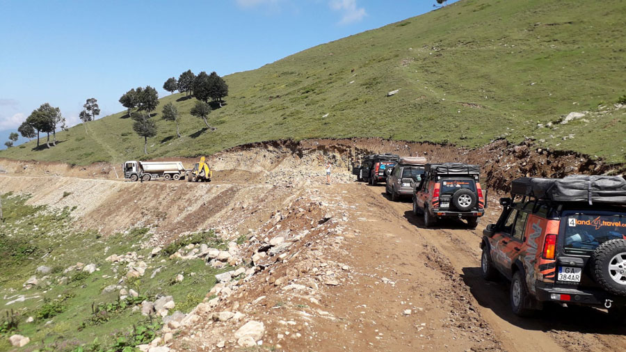
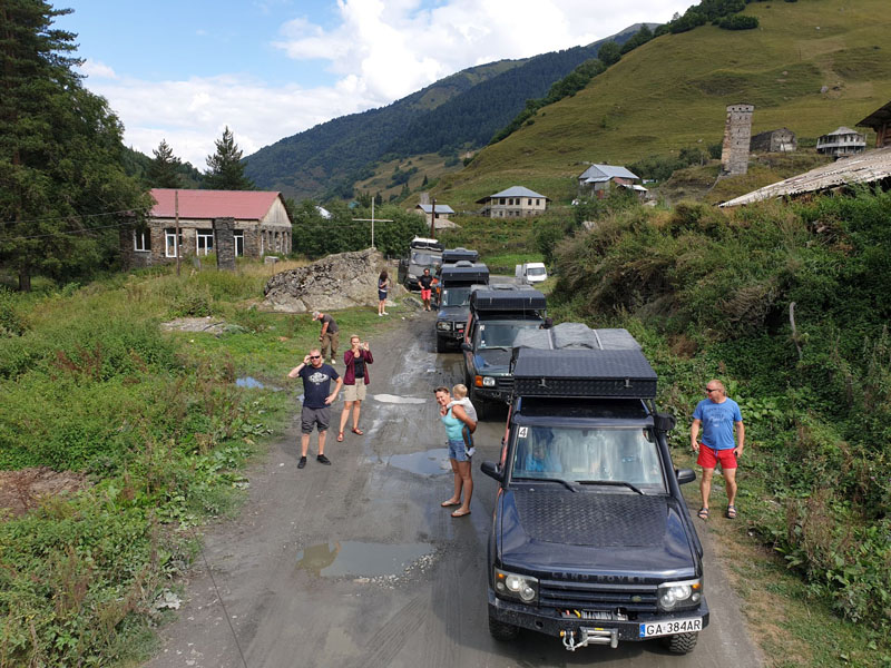
It’s time to leave a friendly – we head to the mountains. Today we are taking a big climb to the 1880 m high n.pm. Omalo. The road from Alvani to a village located high in the mountains is only about 70 km, but it is difficult and full of potholes, so that driving carefully across it takes about 4 hours and this track definitely requires a 4×4 vehicle. Omalo is a starting point for trekking to Shatili, a few dozen kilometres to the east.
The Alvani – Omalo Road is considered to be one of the most dangerous in the world. However, this does not mean that you are taking your life in your hands for every kilometer of the route, although for some people the view out the window can certainly raise the level of adrenaline. It is also the highest-running road in the Caucasus, and the Abano Pass (2950 m above sea level.m) is its highest point.
When taking this route it is important to have experience driving a 4×4, across mountain tracks and also to have a very good sense of distance and the size of your vehicle.. The road is narrow enough that when you encounter a vehicle coming towards you, you have to drive right along the edge of the abyss.
In Omalo itself it is worth seeing the fortress there and you can choose to stay overnight in the guest house or else or go even higher – to Dartlo and spend the night there camping in the wild. From Omalo there is a horse trail to Shatila, every year we are tempted to try to drive it with our cars and every year we say, maybe next year.. In winter, the road is totally impassable.
The Tbilisi hostel, capital in Georgia’s capital
From time to time by the road you can see a small chapel, a monument commemorating those who failed to cross the route through the pass. If you survive the drive… and have not had enough of mountains yet, then lucky you, just ahead is another mountain climb – this time to Shatili – a village located a few kilometers east of Omalo.
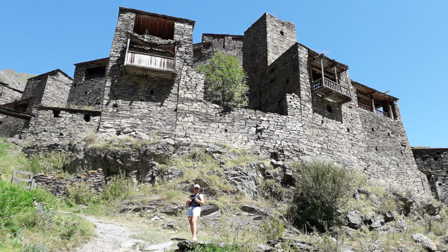
Szatili is a unique monument of folk culture. Dating back to the Deep Middle Ages (c. 12th century), this well-preserved fortress village rises in the gorge of the Argun River, just 4 km from the Chechnya border.
The historic complex consists of about 60 towers, connected with walls or piers. The whole site is a compact, extremely spectacular fortress, at the foot of which there is another place to camp. Shatili, like Mutso, is a place that has not yet been discovered by mass tourism.
The road to Shatila and back takes two days, so going north (direction – towards Shatili) we can stop at Jomardi Rafting Camp, where Georgi takes us for a rafting experience on the River Aragvi. There is a choice of runs here down to difficulty 2+, and sometimes 4+… There is something for everyone.
Going further along our route – we deliberately avoid the congested Gruzian War Road. It is the main route connecting the Georgian capital Tbilisi with the Russian city of Vladikauk. In addition to hundreds of cars and buses with tourists going to see Cminda Sameba and kazbek towering over you ,you would also find overloaded trucks.
The Road to Omalo is one of the most dangerous roads in Georgia
Despite the fact that along a stretch of 165 km of its length Georgian War Road has numerous vantage points and places to stay, the two points really worth visiting are the Truso Valley and the Jute Valley.
Not without reason, the Truso Valley is considered one of the prettiest valleys in Georgia – high peaks, numerous mineral springs and a beautiful valley make an incredible impression on visitors . The road to the valley is narrow and bumpy, driving along a gorge at the bottom of which the River Terek flows. The hardships of the road are rewarded with the views – the towering peaks of the mountains, orange and white travertine, and at the end of the valley the picturesquely located ruins of the Zakagori fortress
Another attraction on our expedition route map is Ushguli, in upper Swaneti. Ushguli is a complex of 4 villages Zhibiani, Chvibiani, Chazhashi and Murkmeli. The complex is located at an altitude of 2100 metres above sea level on the Enguri River at the foot of Shkhara – the highest mountain in Georgia. Very often the area is covered with snow for up to half a year and at these times the road to Mestia is impassable.
While most travelers choose to get to Ushgula across an easier route – from Zugdidi and Mestia, we will choose instead the route through Lentekhi… On this road it is certain that it won’t be easy – rivers in flood, a little mud, a stone, bumpy roads, steep climbs and no phone coverage. Beautiful, right? And if you add to this the fact that snow often lies there until July, then what more do you want in terms of a challenge? Without a decent 4×4 with a high suspension there is no point in driving into this region.
The Upper Swanet region is a UNESCO World Heritage Site , and is an example of well-preserved (thanks to its long isolation) mountain scenery with medieval towers. In the village of Chazhashi there are more than 40 of them, built between the 9th and 12th centuries. Once the towers were used as defensive towers against invaders, the rooms on the ground floor were used as living areas,and on the upper floor there was a granary. The stone towers are a characteristic element of the Landscape of Upper Swanetia and reach a height of up to 20 meters.
Ushguli is surrounded by light green meadows, and in the background always shines white peak of Shkary. This 5,000-year-old mountain is Georgia’s highest peak. If you ever decide to stay a little longer in Ushgula, it’s a great base for trekking on glaciers. Round-trip trekking takes about 10 hours.
Going down – to Mestia – another town on our expedition route, we initially follow the mountain, gravel, and in the rain a heavily muddy and slippery road, which eventually gives way to concrete and asphalt. Although Ushguli and Mestia are only 45 km away, this drive will take us about 3 hours.
Mestia is the capital of Swanetia, a small town that looks like – at least from the outside – a German or Swiss resort. There is an airport, a good hotel, countless hostels and restaurants.
The road from Mestia to Zugdidi, although mountainous and winding, is asphalt. On this segment, there is actually only one attraction – the Jvari Dam, on the Inguri River (42.762417, 42.039227). According to the Georgians, it is the highest arch dam in the world! Built during the time of the Soviet Union on the initiative of comrade Chruszczów. After only a few years of operation, it turned out that the dam is in a bad condition and in danger of disaster, so it had to be rebuilt. The height of 271 meters makes an amazing impression. After the harvest you can swim there – or hire a jet ski or pontoon.
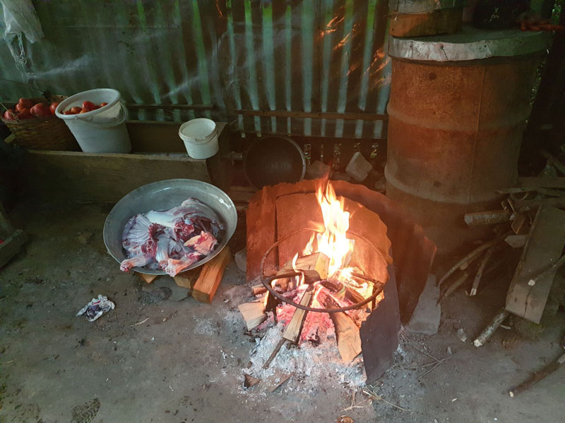
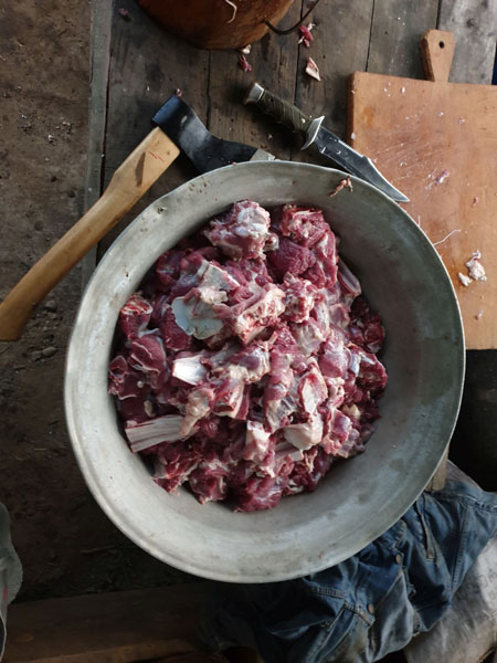
Our Georgian friend prepared a fresh goat for us
Ushguli, located at an altitude of 2,100 metres (6,900 ft) near the foot of Shkhara, one of the highest summits of the Greater Caucasus mountains
Going further in the direction of Batumi – our next point on our route – we go to visit Anaklia, where we will camp for the first night on the Black Sea beach. This is a great campsite, especially those who take their children with them – Anaklia has the only aquapark on the Georgian coast.
We make another, very short stop about a dozen kilometres from Batumi – stopping at the fish market, where you can buy fish of your choice caught from the sea. Just in time to cook it on an evening bonfire on the beach.
For our next overnight stay, we stop in Kobuletti – a seaside resort – on the beach, under the shade of some trees. It is a popular place where local tourists also stay overnight – it’s sometimes noisy, but you can meet very interesting people here. In July, a music festival is held here.
In my opinion -one day is enough to see most of what Batumi has to offer – unless you like to walk aimlessly , sit in seaside pubs or lie on the beach sunbathing. Some things that are definitely worth a look: the Argo cable car, the Ali and Nino sculpture – ‘a Georgian Azerbaijani couple, walk along the promenade’, and also make sure to eat a good ‘Ajar khachaurii’ in one of the port pubs.
After a few hours of sightseeing we hit the road again – this section will not be easy, although the first kilometers will seem like it. We will take the old Route SH1 via Khulo, the Goderdzi pass all the way to Achalcichle.
At the beginning we will drive along a nice asphalt road, which over time narrows more and more, until it finally becomes a gravel path. Most travelers choose an easier way, but we will still go this way to visit Timura – our old friend. We got to know him a few years ago when we got lost in this region.
In Khulo we turn right and through the tiny villages of Ajaria where we take some off-road shortcuts to get to Goderdzi. In this area, an off-road rally is held every year, where cars from Georgia, Russia and Turkey participate
After overcoming the Goderdzi Pass, we still have a long way to go to Achalcichle – on the way you have to be careful to keep an eye out – on the left side as you drive you will pass Jova, a nice Georgian who runs a roadside bar. In addition to delicious crazes, you can stock up there with a deliciously clean, pre-distilled cha-cha – strong vodka made from grapes. 😉
Shatili, historic highland village in Georgia, near the border with Chechnya.
After a few hours of driving, we will finally reach Varda – the destination of our expedition. Make sure to stop at the vantage point (41.379207, 43.287176), from where you can admire the entire panorama of the rock city. Vardzia is an absolute “must see” when traveling around Georgia.
The rock town was founded at the turn of the 12th and 13th centuries, initially as a fortress for the army, which was later transformed into a monastery.
The whole complex is located at an altitude of 1300 m above sea level and is beautifully located above the canyon of the River Mtkwati. Today only about 250 rooms have been preserved, as well as individual parts of corridors, tunnels and water and sewerage systems. During its heyday, up to 60,000 people stayed there at the same time.
Partying in downtown Tiblisi before retiring to the vehicles
When camping overnight – it is best to choose a large clearing on the other side of the river or else to camp near the hot spring located 1.5 km from the monastery.
Thinking now of our return route, we have two route options – one is easy – asphalt through borjomi park or the more difficult route through tabatskur national park and… naturally, we choose option 2, we can visit Borjomi another time.
In Tabatskuri we will enjoy a nice bit of good offroad driving, we drive around the lake from the north and a really difficult route from Bakuriani to Manglisi, and then at the end a straight asphalt road to Tbilisi, finish our journey.
Tbilisi – the capital of Georgia is also worth seeing. Without a doubt, it is one of the most interesting cities that I have had the opportunity to visit. It has changed a lot in recent years, but it has retained its unique character.
If you have two more days to spare it is worth visiting the capital of Georgia, Tbilisi. The focal point of the city is Freedom Square – which is a huge roundabout with a statue of St. George, patron saint of Georgia, in the middle. Then, walking along Pushkin Street, we come across the ruins of the old town and the monument of the lighthouse keeper. In my opinion – the city looks much better after dark, when the lights the illuminate buildings and monuments and this looks really cool.
On the way back – we will enter the sulfur baths, which are a legacy of the Turkish inhabitants of the city, and have a massage. There is nothing more relaxing, especially after the hardships of a nearly month-long expedition…


Hoi!
Graag wilde ik een vraag stellen naar aanleiding van jullie mooie reisblog over Georgië. Mijn vriend en ik willen aankomende zomer namelijk graag een rondreis door Georgië doen met een auto en daktent. We vroegen ons alleen af hoe veilig het is om je auto te parkeren en daarna voor twee nachtjes de bergen in te trekken met je tentje aangezien dat een van onze dromen is om te doen. We willen voorkomen dat vervolgens onze spullen uit de auto worden gestolen of de huurauto verdwenen is. Ook vroegen we ons af hoe veilig het in het algemeen is om de auto te parkeren in Georgië? Het zou heel tof zijn om jullie ervaring te horen! Alvast bedankt voor jullie reactie. Vriendelijke groetjes, Nienke van Duijl en Jop van Bakel
Georgia is a safe and very hospitable country. Of course, there are accidents … but it’s rare, especially in mountains. As for the car, I would advise you to leave it in the yard in the nearest village. In cities, you can park wherever you want, it’s safe. There is a proverb in Poland “strzeżonego Pan Bóg strzeże” what means – “better safe than sorry 🙂
Tomek- Land4Travel