
ICELAND Forgotten tracks – with Geko Expeditions. In this article we join Peter, a participant, in a recent Geko expedition in Iceland..
No other country offers such diversity : black, red or grey deserts, young volcanoes, exuberant calderas, magical lakes, gigantic glaciers, canyons, aerial ridges, lava fields covered with 30cm of mosses, torn fjords, black beaches …
NO OFF ROAD DRIVING
Before planning any trip to Iceland, it is important to remember one of the fundamental rules. The practice of driving off-road in Iceland is strictly prohibited and strictly repressed. As soon as you drive off the ferry , you see the police distributing flyers containing information on these rules. And many sign posts exist across the island to continually remind you of this. No one can pretend not to know it.
‘Newly made’ off-road tracks can remains visible for over 20 years, where fragile mosses struggle to survive and where, even dry on the surface, the soil is full of water. The sustainability of fragile ecosystems and the beauty of these pristine landscapes is at the cost of this simple rule :no off-road driving . However in truth, offroad driving is not necessary to enjoy touring Iceland. There are many tracks already laid out allowing access to the most remote and interesting places in the country.
PLAN YOUR JOURNEY
Any trip to Iceland for anyone who wants to go with their own vehicle starts as you exit the ferry exit in Seydisfjordur . The same ferry has served Iceland for many years and its capacity has not grown to meet demand and as such, it is highly recommended to plan your summer trip to Iceland well before Christmas of the previous year and the same logic applies if you decide to booking a trip with Geko Expeditions .
HIGHLANDS
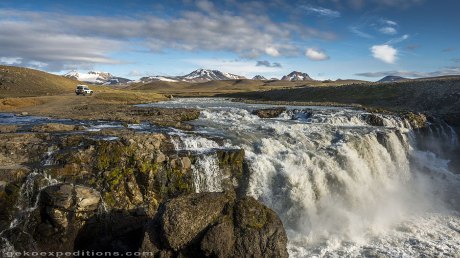
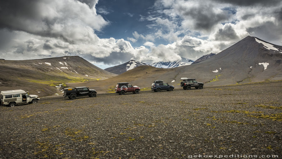
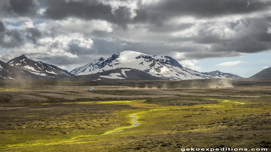
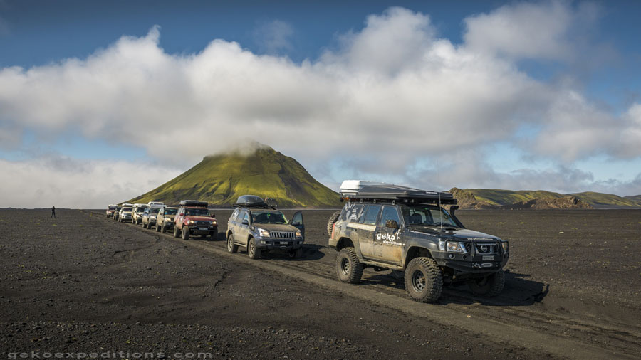
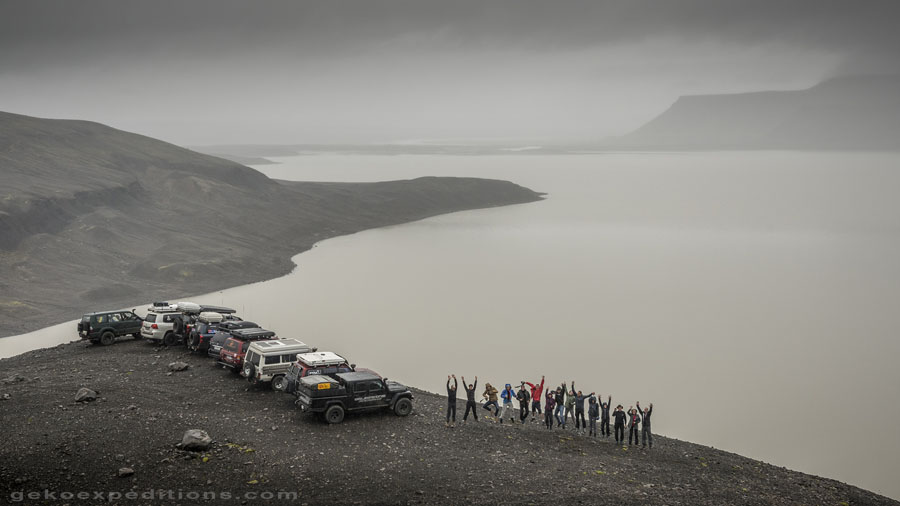
After stocking up with solid fuel and groceries for a week of autonomy, the group, consisting of 6 vehicles and 14 participants and the Nissan Patrol of Geko Expeditions occupied by our guide and expedition leader Oliver, rushes out of Seydisfjordur to attack the highlands of eastern Iceland travelling over a small winding road. The clouds move aside and reveal Mount Snaefell (meaning Snow Mountain), a real beacon in the landscape. This part of the island is a typical northern taiga setting. The few trees still present in Iceland are at the bottom of the valley that we leave behind.
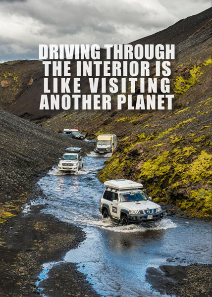
We soon drive onto a small track that takes us over a ridge to discover some small lakes hidden behind the hills. As we approach these, we see some wild geese fly away. Oliver knows every corner of this magical country. He is quick to remind us all about the rules for river crossing: engage low gears, and maintain a constant and low speed in the water. Large stones that can open a differential case can easily lurk in the icy bed of the streams.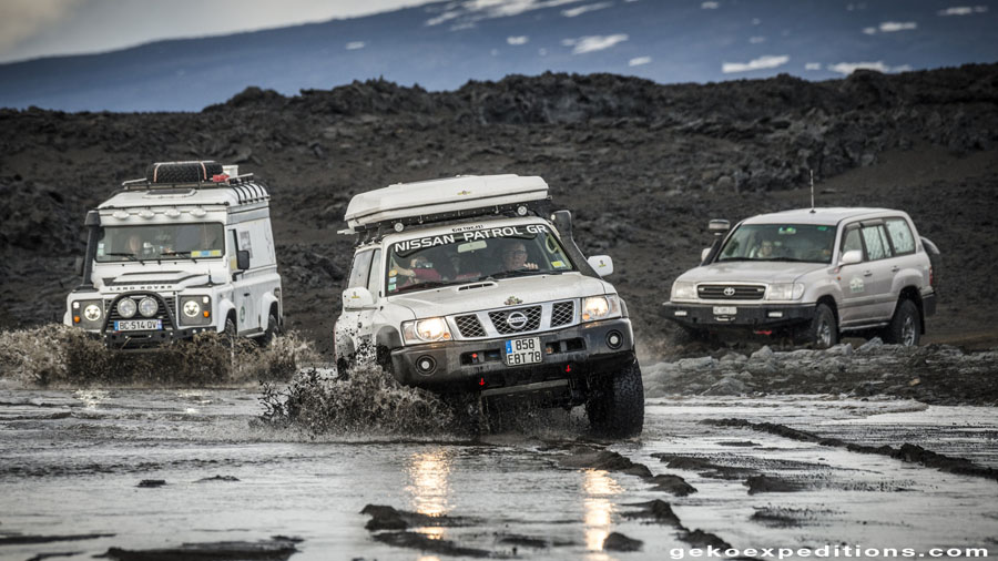
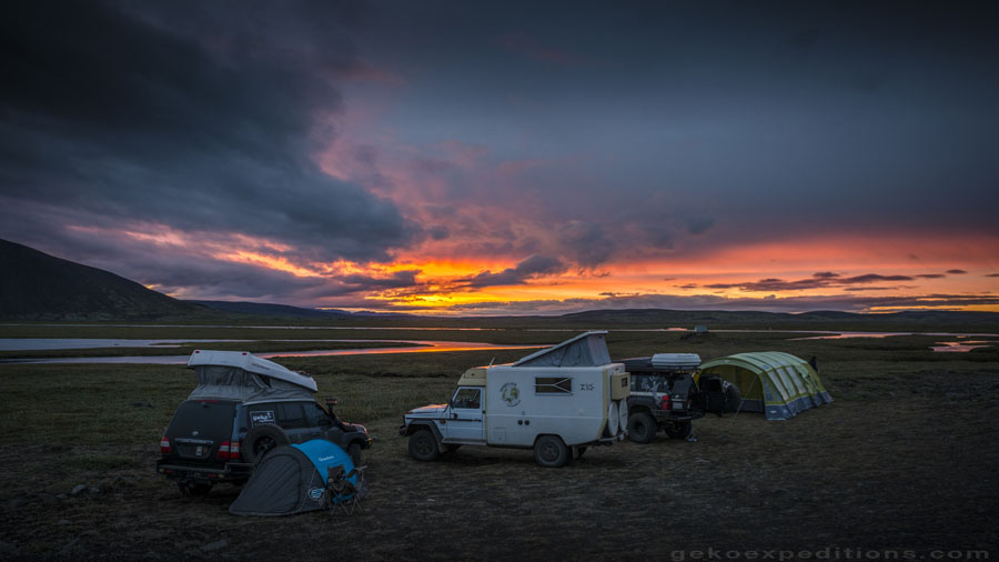
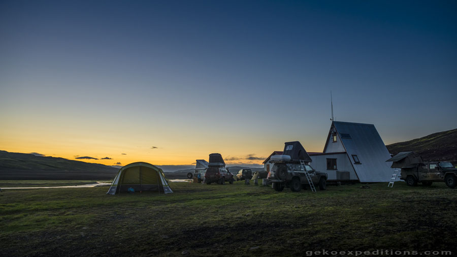
Fast spectacular crossings producing big sprays of water squirting at 5m high are best kept for the movies, it’s now to do it in real life! This is the first big test of nerve for most participants. It’s not every day that your hood disappears under the water of a river … It is particularly important to follow the trajectory outlined by Oliver, on pain of falling into a hole and getting stranded. . That first evening, the clear sky of July and the excitement of the beginning of the trip kept us awake for a long time in a sublime camp location at 700 m altitude.
IN THE HEART OF A VOLCANO
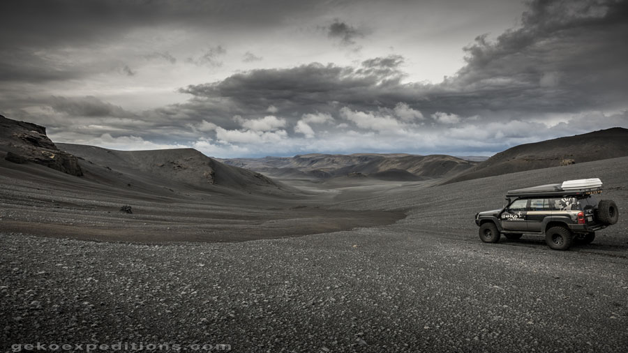
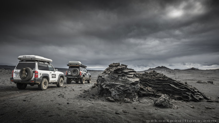
The cold and the frost on our tents in the morning reminds us that we are at 65 ° north latitude. After a quick breakfast and a briefing outlining the day ahead, we’ll go to visit our first lava field … and it will not be the last. The landscape created by the solidified lava, layers of unreal shapes and basalt blocks , never ceases to amaze. Some of the group even claim to see some trolls … It looks to us like the eruptions took place only yesterday. Most of the Askja volcano lava flows, date ,however, from 1875 . The weather is not so good this morning, but we could not resist a trip up the sides of this mythical volcano .
The access path had just been opened for the day and, after a 45 minute walk inside the caldera, still covered with snow, we arrive at the edge of the Öskjuvatn frozen water lake . It seems crazy to be in the heart of a volcano that is still active, the last tremor having been felt in August 2014, (during the eruption of the glacial volcano of Bárdarbunga) . Beside the crater of the cold lake is another lake, much smaller, Lake Viti (lake of hell in Icelandic ). It consists of warm water and is opal in colour. It was hard to resist the temptation to take a bath here.
THE OLD TRACK
Tonight at our next camp, Oliver receives a call that cheers us all up. Rangers at Vatnajökull National Park have invited us to attempt the crossing of the famous old track Gaesavatnleid next day. We will be the first to attempt the crossing this particular year . This legendary track is considered one of the most difficult on the island. It is the original track crossing the country from east to west and was created well before the F910. Crossing the island along the northern foot of the huge Vatnajökull Glacier has always been considered difficult and dangerous. With an altitude of over 1200m. It is usually one of the last tracks to open in summer.
There are years when it remains impassable , still covered in snow. The team at Geko Expeditions is well known to the guards of the Vatnajökull Park and in particular to rangers present in this region. They know the expertise of the Geko guides and know they can be relied upon to enforce the rules while re opening a track for the first time of the season : Respect the original layout of the track , including when the latter is covered or obscured in snow. And that it is forbidden to make a detour through an area of open ground in order to bypass snowfields or mounds of snow.. This activity would cause irreparable damage to delicate terrain.
The rangers also relies on the fact that the Geko vehicles as well as those of their customers are generally well prepared and able to travel in difficult terrain. A sign at the beginning of the track indicates that this track is reserved for ‘superjeeps’ . The rangers are usually busy enough running education and relief operations conducted for over a century for the benefit of tourists venturing into the Highlands by Dacia Duster or similar vehicles.
THE ALLUVIAL PLAIN
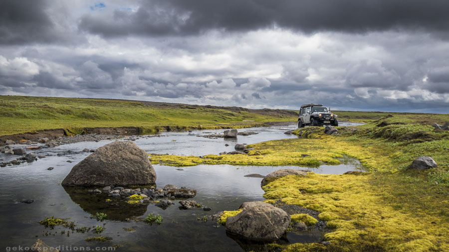
The first obstacle on our east-west crossing is an immense alluvial plain of about 15 km in length. It is especially important not to venture into the floodplain at the wrong time. Indeed, various weather conditions can transform the plain into a lake thanks to the melting of ice from Vatnajökull . We need to deflate our tyres according to Oliver’s instructions. And the instructions from Oliver are clear, vehicles must remain in tight convoy and drive in the tracks of the preceding vehicles. Passing 2m to either side may result in the immediate stalling of the vehicle. Oliver tells us to maintain an engine speed above 2500 rpm so as not to be surprised by a soft zone. We lock the central differential, and hit third gear…low range..
HIGH IN EMOTION
The weather is unfortunately not favourable today. A strong wind blowing horizontally raises lots of sand, making it difficult to read the terrain. The water already partially covers the plain from 20 to 30cm. Again the leader’s instructions are clear , maintain momentum .. The areas of soft sand are eventually replaced by harder areas on which vehicles begin to regain grip and speed. Some sandbanks cause us to stop completely and when out of them we go on again for a new portion, on off … it’s a long 15 km !
And suddenly, we all hear a call on the radio : “ Oliver, I’m stuck ! “. The second last vehicle , a heavily loaded HDJ100 has crashed into a soft area . Despite the warning, he remained in high gear …. Fortunately, the last vehicle was able to stop on a patch of hard sand. Oliver then gathers all the other participant s and leads us out to the other side out of danger of rising water. He turns back to rescue the unfortunate vehicle. The Nissan pulls the Toyota out of this bad scenario. It was time timely too because during the hour necessary for the maneuver, the water level rose around us by an additional 20cm.
A SPECTACULAR VIEW
After a welcome lunch break, the group leaves and starts the climb to the foot of the glacier with heavy snow. The track is almost invisible. We must slalom between big stones that the lowest vehicles can not always avoid. We soon meet first patches of snow. Sometimes using our momentum, sometimes at extra-slow speed, Oliver gives us his science of driving on snow. Vehicles with large wheels are at an advantage. A Hilux with 18 “wheels and original size tires will not be able to ‘float’ and will not be able to cross one of the snowfields.
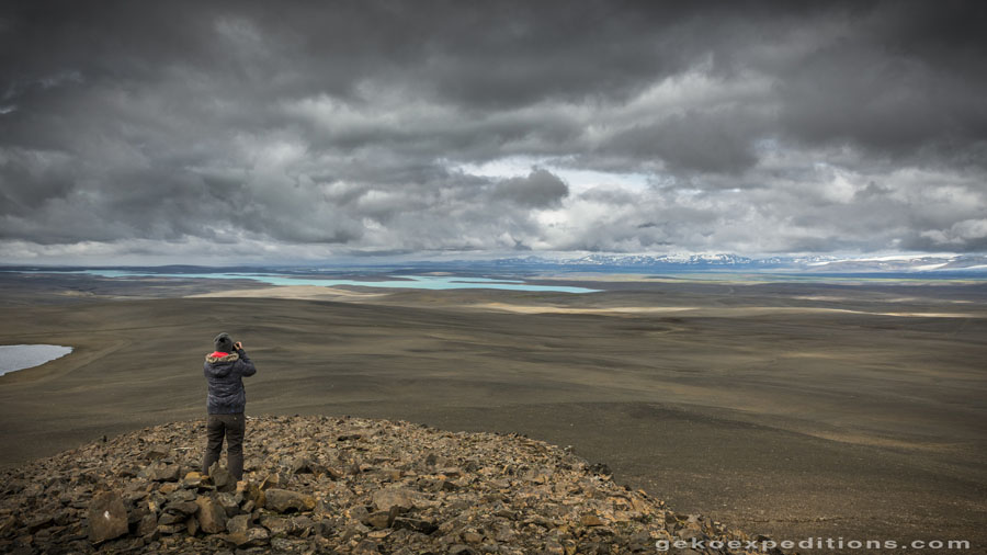
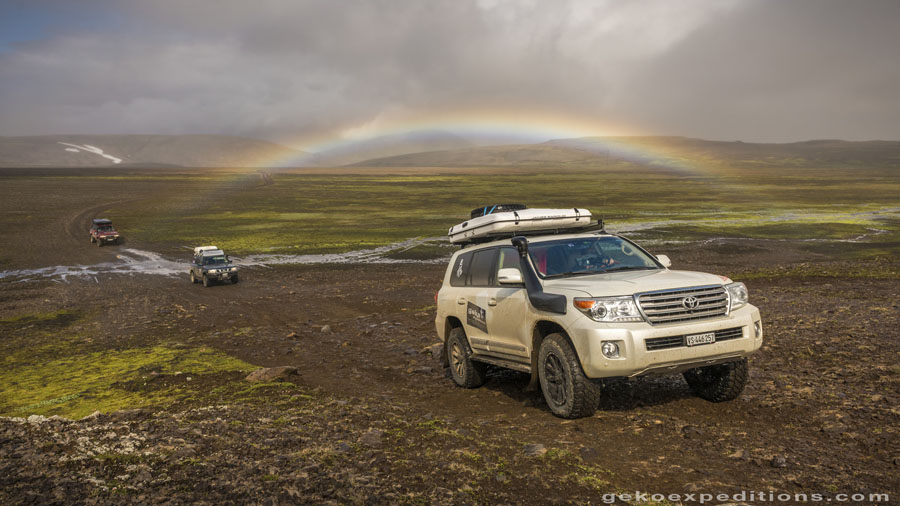
As we gain altitude, the weather improves and the view becomes striking. We soon see the Northern Highlands at our feet . We can see at least 50 km into the distance . We realise how tough and unforgiving this country is. No living soul or sign of life as far as the eye can see. We continue along the face of the glacier, covered in sand and stones, sometimes the ice seems to glow a sublime emerald green. After some adventures and many photo stops, we again head down and return to a valley covered with soft green grass . Wild geese are nestled at the edge of the river and watch us, curious to see these big beasts of steel intruding in their territory .
Tonight, we’re camping next to a deliciously hot spring. After this extraordinary day that everyone will remember, the participants are feeling very relaxed and simply happy after a day of great adventure. The heat of the bath finishes of even the most energetic of us and sleep finds us all very quickly.

BLACK DESERTS
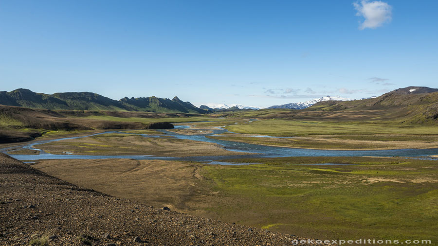
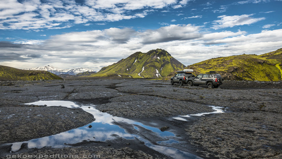
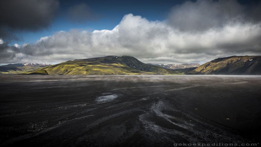
We continue our journey into the Highlands by approaching the region of the black deserts. If black or grey rocks are omni present on most of the island, the area we discover is special. No vegetation grows on this corner of the country. Grey sand and black volcanic rock cover everything, as far as the eye can see. A really lost track meanders between peaks and lava fields, before climbing over a ridge where a vista looking something the end of the world is revealed. No colour at all on the horizon. From this grey austerity nevertheless comes a feeling of harmony and very particular beauty. When the sand is wet, it is black. 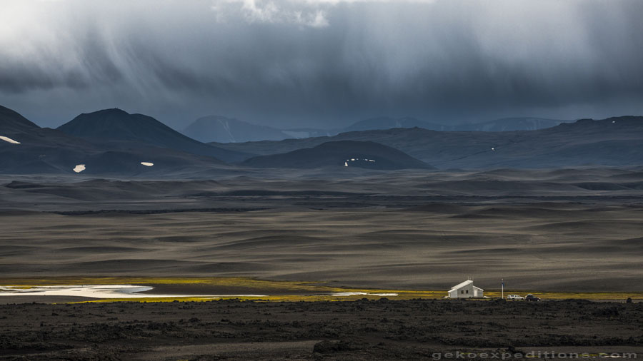 The wind sculpts ripples and dries out the exposed areas giving rise to a fantasy of grey and black. Sometimes it seems like a Hallucination. If the sand was yellow or orange, we could almost be in the Saharan Tadrart .
At the heart of this dull and dreary sight, a string of lakes hemmed in fluorescent green suddenly appears. As if the desert vista was not enough, the track then alternates between crests and lakeside, sometimes being 4m wide between 2 expanses of water … We have no words to express how amazing this felt,. Iceland has conquered the hardest hearts today.
THE BOILING HEART
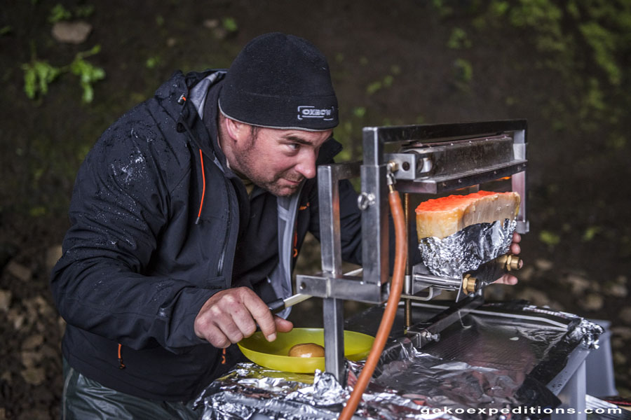
The next day we start out on some fast and easy tracks, before committing ourselves again on a small lost track known only to Geko Expeditions and the locals. We continue to turn around the glacier Vatnajökull, which is as big as Corsica. We are approaching this time its west side. Unlike previous days here the mountains are generously covered with grass, moss and lichens.  The track approaches the high mountains in the centre. We come across some snow passages which we need to negotiate in short bursts of speed and torque with tires at 0.8 bar. Between the 2 peaks, we enter a valley with dozens of steam fumaroles. The ground is hot. We get out of vehicles to explore this magical region on foot. A symphony of colours that is offered to us.
  Ocher earth or dark red, fluro green lichen, grey sand, green-grey moss. Iceland definitely conquers us by welcoming us to its secret and bubbling heart. Oliver’s high mountain guide qualification is useful in making sure that none of us venture into dangerous terrain. Indeed, some areas of snow seem solid and buoyant, while in fact the earth is boiling below. Understanding where you are walking in this landscape is very important here.
CROSSING A LAKE IN 4X4
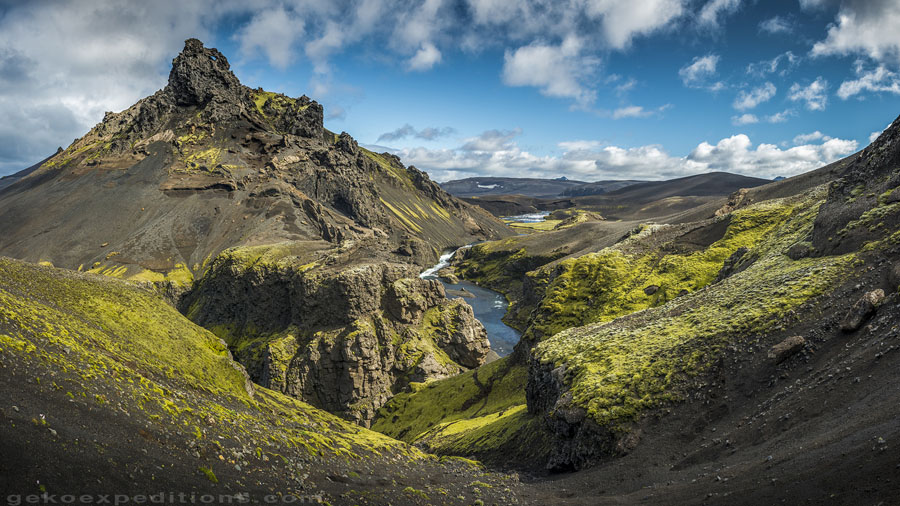
We continue our progress and descend 300m. We then traverse several valleys each one more beautiful than the next . The rivers are sometimes spread over several kilometers, creating wetlands colonised by magnificent fields of cottongrass ( Eriophorum ) which look immaculate and silky.
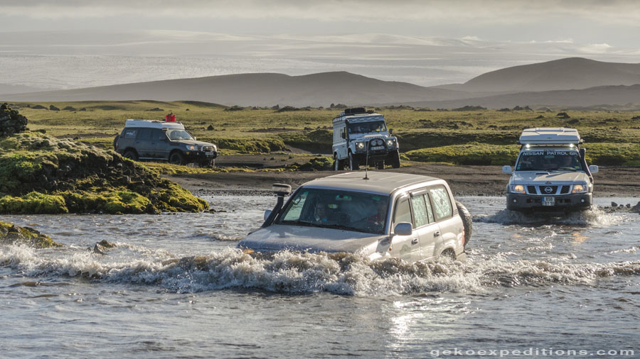
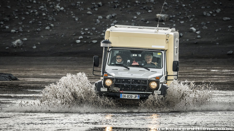
At the bend of a rocky escarpment, we tumble in front of a lake between high mountains. We hear Oliver on the VHF : “ Are you ready to cross a lake ? “ And of he goes alone and sinks into the lake with his black Nissan Patrol . He asked us to wait … which is not always a good sign … The vehicle progresses 5M from the shore in about 60cm of water where there is a flat bottom.
The Patrol is soon only a dot in the distance. But we can clearly see that he has just come out of the lake on the other side. Unbelievable. Oliver then explains that he wanted to make sure that no stones that had rolled from the mountain were blocking the passage before allowing the whole group to cross. Is with a mixture of tension and elation that we travel the 400m across the lake, of course, not without forgetting to engage the GoPro.
After another day of discovery more and more amazing sites, and we reach the south coast of the island where we make a well deserved stop for a night in a comfortable hotel, after 1 week of travel and living on the road . We will continue now for a second week different tracks but equally intense, before joining Seydisfjordur to catch the ferry. The two day ferry crossing will be necessary to assimilate as much as we can, the emotions of this unforgettable trip. We feel like we left yesterday … These 2 weeks have passed so fast for us. We saw so much beauty and lived so much intense experiences…. Intense. This word best summaries our trip. Highly the next, life is too short.
GEKO EXPEDITIONS
off the beaten tracks 4×4 tours
selfdrive and guided in english and french
E-mail: [email protected]
www.gekoexpeditions.com
Facebook:facebook.com/gekoexpeditions/
YouTube: www.youtube.com/geko4x4com
Instagram: https://www.instagram.com/geko_expeditions/
Address: Amaris 1 – CH-1645 Le Bry –
Switzerland
![]()
Recent Comments