
Photo: Nicolas Genoud- Geko Expeditions
Humans have been navigating across vast expanses of land and open seas for at least 4000 years, and probably a lot longer. The first western civilization recorded to have developed methods for navigation at sea was the Phoenicians who from around 2000BC used charts and observations of the sun and stars to find their location and to determine their direction of travel. The progress of time and history and human ingenuity has brought us a constant stream of innovation as techniques were discovered and technologies developed to continually improve the ability of people to navigate across great and unknown distances.

Early Instruments
Latitude can be discovered reasonably easily by navigation by the stars, in the Northern Hemisphere sailors could find the latitude of their current location by measuring the altitude of the North Star above the horizon, this angle in degrees was the latitude of the ship. The ‘Icelandic sunstone’ is a type of mineral that is reputed to have been used to locate the sun in overcast and snowy conditions, polarising the sunlight when used to look at the sun and determining the azimuth thereby making it easier for early sailors to navigate by the sun in a variety of conditions.
A sextant- https://en.wikipedia.org/wiki/Sextant#/media/File:Sextant.jpg
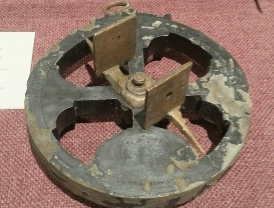
One of the first man made navigation technologies was the Mariner’s compass, which was an ancestor of a modern magnetic compass. These early compass were often considered to be unreliable as the difference between true north and magnetic north, and of magnetic variation was not understood.

An Icelandic Sunstone – https://en.wikipedia.org/wiki/Iceland_spar#/media/File:Silfurberg.jpg
During the 13th Century sailors began to record detailed records of their voyages, and transformed these records into charts, thus creating the first nautical charts. Early charts were inaccurate but were still valuable. These charts did not show latitude or longitude but there were markings showing the compass direction of travel between major destinations.
A Mariner’s astrolabe c.1645 https://en.wikipedia.org/wiki/Sextant#/media/File:Sextant.jpg
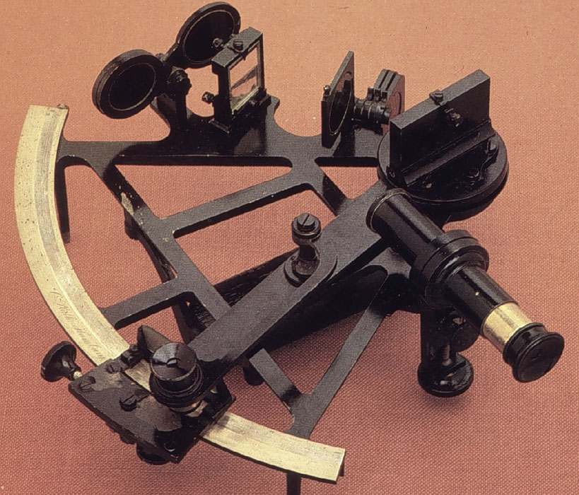
Some of the first instruments used by sailors to determine latitude were the astrolabe and quadrant. The astrolabe was invented in ancient Greece, and was initially used by astronomers to tell the time, it was brought into service by sailors in the fifteenth century to measure the position of the sun and stars and thus to determine latitude. Around the year 1730 two men across the world from each other, English mathematician John Hadley and American inventor Thomas Godfrey , each independently invented the octant, which gave sailors a much more accurate tool for determining the angle between the horizon and the sun, moon or stars, in order to calculate latitude. This instrument was later further developed by Admiral John Campbell who proposed a modified design which produced the first sextant in 1757.
Throughout all this time, the tools were available to determine latitude, but longitude was more difficult, and could only be estimated and not measured, longitude was calculated by comparing the time of day difference between the starting location and new location, but up until the eighteenth century even the most accurate clocks could lose up to 10 minutes per day, which could lead to inaccuracies of up to 150 miles or more in calculating location.
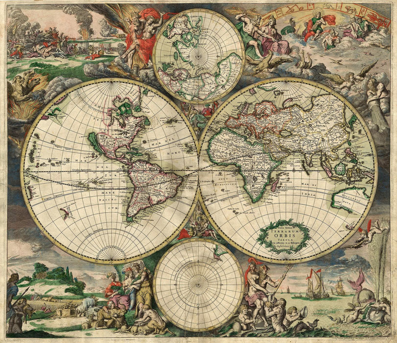
https://en.wikipedia.org/wiki/History_of_navigation#/media/File:World_Map_1689.JPG
However the invention of an accurate chronometer in 1764 finally provided an accurate means of calculating longitude. In 1884, the Prime Meridian (located at 0° longitude) was established internationally as the meridian passing through Greenwich, England.
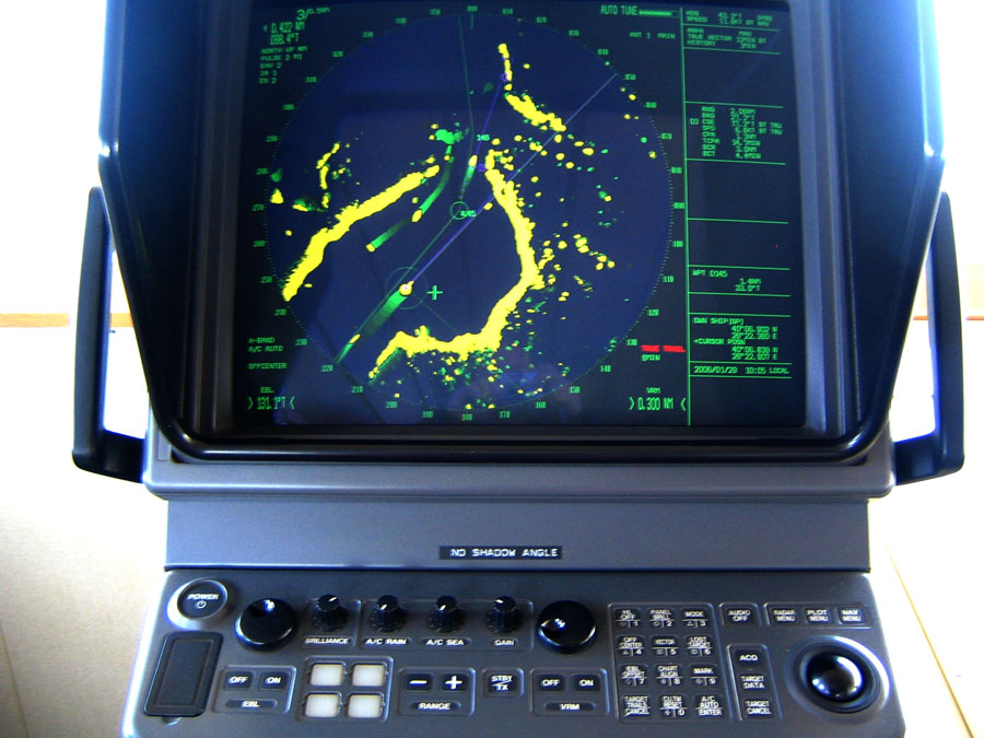
Radar Navigation- https://en.wikipedia.org/wiki/Radar_navigation#/media/File:Radar_screen.JPG
MODERN NAVIGATION
The 20th century continued to evolve the ease of use of traditional instruments and also brought some important new technologies to navigation, including radar, radio beacons, gyroscopic compasses and global positioning systems.
The gyro compass was invented in 1907 and was an improvement over a magnetic compass in thatit is unaffected by external magnetic fields and always points to true north. The first radio detection and ranging (Radar) system came into service in 1935 and could be used to locate objects that were beyond the range of vision by bouncing radio waves against them.
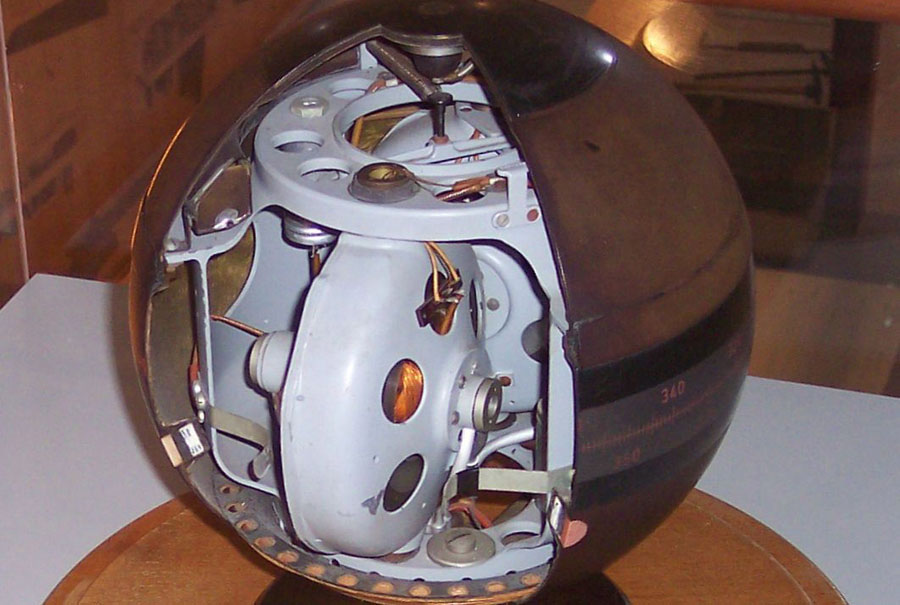
Cutaway of a Gyrocompass https://en.wikipedia.org/wiki/Sextant#/media/File:Sextant.jpg
Between 1940 and 1943 in the USA a navigational system called the ‘Long Range Navigation (Loran) was developed and used pulsed radio signals between numerous ‘stations’ to determine the position of ships, this was accurate to several hundreds of meters but was limited in coverage by the location of the various stations.
Towards the end of the 20th century, the Global Positioning System came to replace Loran. The GPS system uses the same principle of time difference from separate signals, as with Loran, but with GPS the signals come from satellites orbiting the earth. Today there are a total of 24 satellites in the GPS constellation. There are also 24 operational GLONASS satellites, GLObal NAvigation Satellite System”, is a Russian space-based satellite navigation system. There are also 24 Galileo Navigational satellites, Galileo is the European global navigation satellite system that went live in 2016.
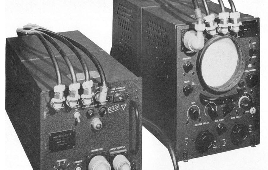
Loran Navigation System – https://en.wikipedia.org/wiki/LORAN#/media/File:LORAN_AN-APN-4_receiver_set.jpg
GPS/GLONASS/Galileo is now the most accurate means of global navigation. GPS has up to 1 meter accuracy. Most modern GPS Systems used by both sailors and overland explorers today use signals from GPS and/or GLONASS satellites.
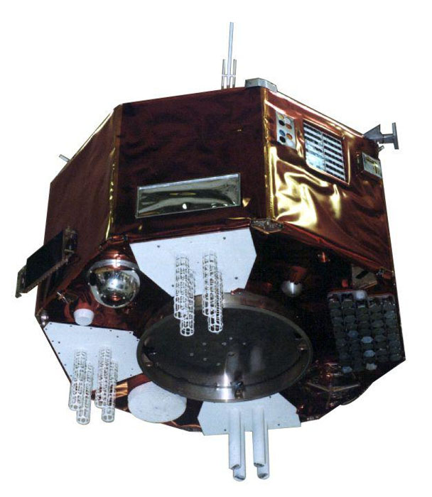
Early GPS Satellite – https://www.researchgate.net/figure/Illustration-of-the-Navigation-Technology-Satellite-2-NTS-2-The-satellite-included_fig1_258812899
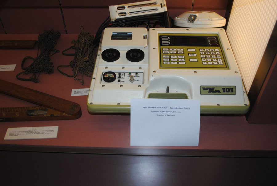
World’s first portable GPS System- https://en.wikipedia.org/wiki/Global_Positioning_System#/media/File:Leica_WM_101_at_the_National_Science_Museum_at_Maynooth.JPG
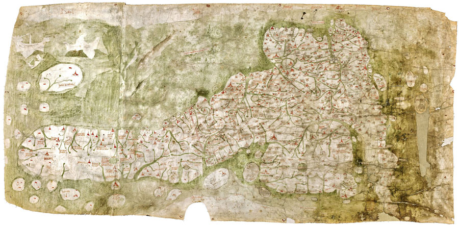
Gough Map- https://en.wikipedia.org/wiki/Gough_Map#/media/File:Gough_Kaart_(hoge_resolutie).jpg

An Iranian Astrolabe – https://en.wikipedia.org/wiki/Astrolabe#/media/File:Iranian_Astrolabe_14.jpg

Photo: Aleksander Veljkovic
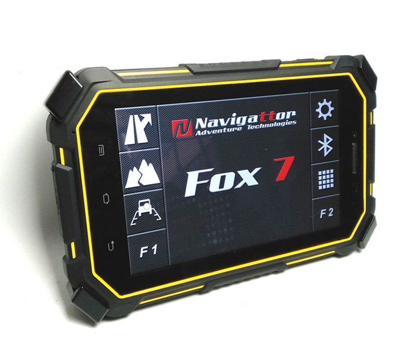
The FOX-7 OFFROAD GPS

Our readers will be familiar with our go-to navigation system much used and relied upon when we are out exploring unfamiliar territory and off road tracks, that is the FOX-7 Offroad Navigation system from Navigattor.com . The Fox 7 has a high-gain GPS receiver which is 10 times more accurate than the positioning available on a phone or tablet.
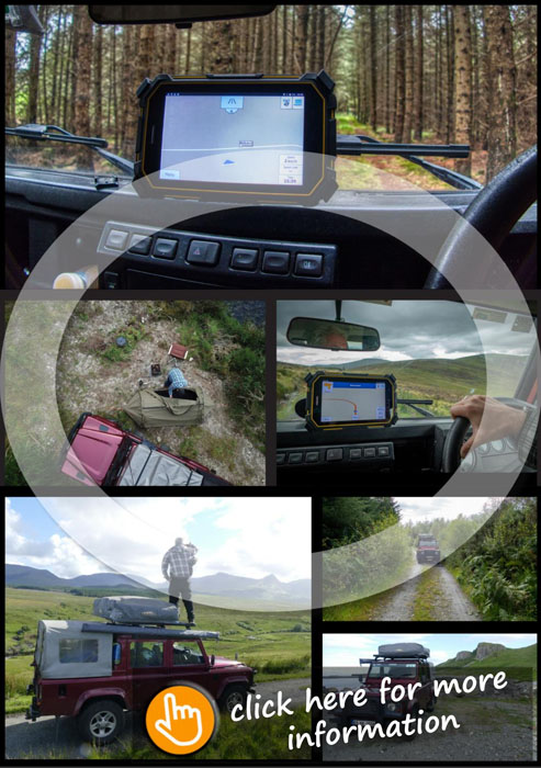
These units are perfect for offroad navigation, so rugged and reliable they can be used on bikes and quads as well as offroad vehicles. The Offroad Navigation is performed by the OziExplorer app, with a custom made interface developed by Navigattor.
Worldwide topographic maps for OziExplorer are free of charge for the owners of Navigattor GPS devices and are pre-installed on the device by request when ordering from Navigattor.
Like early mariners, marking unknown routes on their charts, the OziExplorer app allows you to load Waypoints and Track files in GPX format and to upload and also to export routes and share with others.
The team at Navigattor will be able to advise you on the available world-wide topographic maps and can also pre-install any maps that you require onto the device before they send the FOX-7 Unit out to you.
Navigation systems have come a long way, and the amount of technology compressed into such a rugged and reliable device is impressive. You can learn more about the FOX-7 at Navigattor.com.
![]()


Recent Comments