
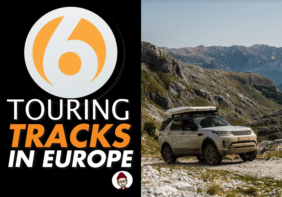
 Are you thinking about a remote 4WD and Camping Adventure in Europe over the coming months? If we are to believe what some of the experts are saying, remote traveling could just be the next biggest thing. In the Southern Hemisphere Australians have been enjoying remote 4WD touring for donkey’s years, packing up their vehicles and tackling iconic tracks all over the Land Down Under, there is no doubt about it, the Aussies are blessed to have so much choice in their vast and sparsely populated continent.
This is what we have all missed in recent months
Sure we don’t have the large open spaces and deserts like they have in Australia but that does not mean that Europe has nothing to offer. Quite the opposite in fact, bordered by the Arctic Ocean to the north, the Atlantic Ocean to the west, and the Mediterranean Sea to the south you could easily spend a lifetime visiting remote campsites and exploring the network of tracks that connect approximately 10,180,000 square kilometers of very diverse terrain. We caught up with some of Europe’s best known 4WD touring operators to check out what gems they have in their own backyards .
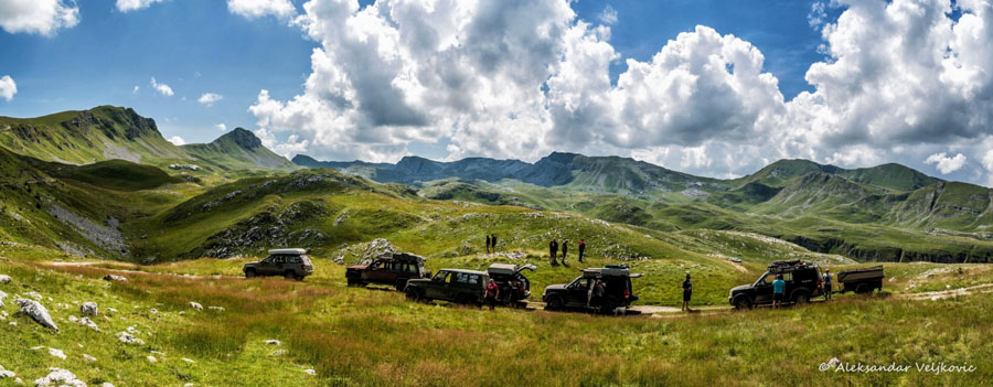
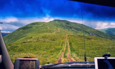
1.TRACK – STARA PLANINA COUNTRY – SERBIA DISTANCE -200-250KM
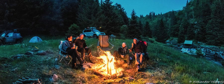
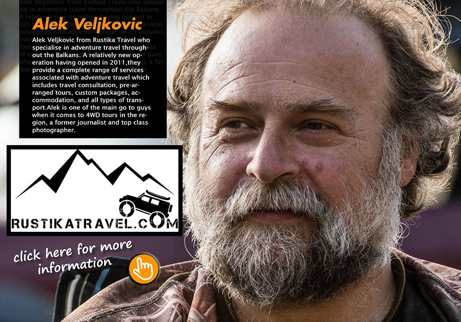
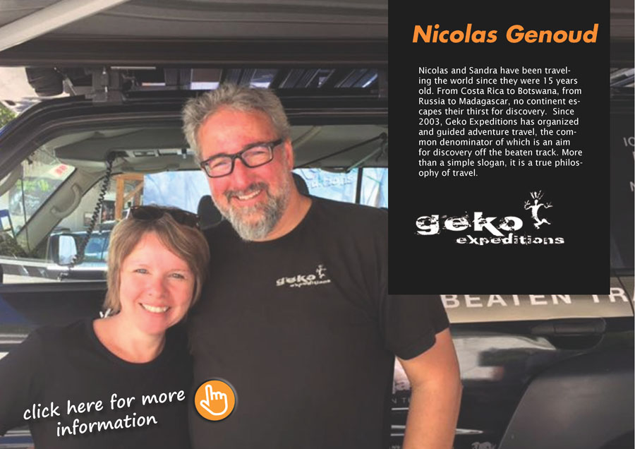
We recently caught up with Alek Veljkovic from Rustika Travel who specialise in adventure travel throughout the Balkans. A relatively new operation having opened in 2011,they provide a complete range of services associated with adventure travel which includes travel consultation, pre-arranged tours, custom packages, accommodation, and all types of transport.Alek is one of the main go to guys when it comes to 4WD tours in the region, a former journalist and top class photographer, Alek gives us an insight to some awesome tracks in both Serbia and Montenegro.
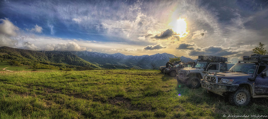
This trail follows the main ridge of the Balkan mountain called Stara Planina in Serbia, that stretches along the Serbian-Bulgarian border, reaching about 2110 m at the highest point (from where a 10 minute hike takes you to Midzor, the 2170 m tall highest peak of the mountain). The trail features a lot of open grassland riding along the ridges, but also some potentially muddy passages through the forest that are difficult to avoid.
 For the most part it lies above 1000 m, expect some incredible vistas. Several variations of routes are possible for example, you can choose to skip the difficult ascent to Beledje pass and Bratkova Strana peak (parts of this section features some quite heavy water damage on the trail, that stretches into the difficult category), you can take the road from Topli Dol towards the Zavoj lake, you can then climb in the direction of Mramor and Bratkova Strana from that side. Keep in mind that the trails aren’t marked, and there are many possible variations, taking an organized overlanding tour or getting local guidance is advised.
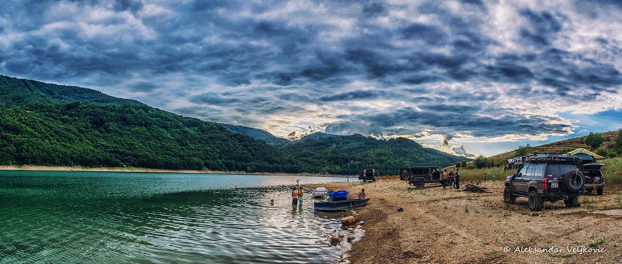
Features that should not be missed along this route include impressive rocks of Babin Zub (it is possible to drive all the way to the top of the rocks), the Midzor peak (the highest peak of the mountain), some of the many spectacular waterfalls of Stara Planina (the upper Pilj waterfall is, for example, only 150 m from the trail), the Vrtibog grasslands and the spectacular Arbinje valley are awesome.
The red rock riverbeds of the Arbinje valley may be the most beautiful place for wild camping in Serbia. Further attractions include the Zavoj lake (also a great place to camp), the Ponor Cave above Dojkinci village, the ascent to Kopren Peak and the ascent to Kukla Peak ,a great scenic view. Alek recommends that you should also visit the pub in Dojkinci village if you are passing it that brews it’s own beer, or visit the Gostuša village, which is impressive for it’s ethno architecture preserved through the centuries. The Toplodolska river valley is also an attraction that deserves a few days exploring, with many waterfalls, some of which require a walk to so bring your hiking boots.

Alek highlighted that while driving along the border patrol trail in the south-eastern part of this track (from the Tupanac peak onwards) take great care not to accidentally make an illegal border crossing into Bulgaria, as the border is at some points only metres away.
Although this is a nature park, there are no strict rules for camping, so you can camp practically anywhere you like. Aleks favourites are the red rock river valleys and by the Zavoj lake, you can also find some great camping in the higher altitudes on the endless grassland plains (for example, near the water spring at Vrtibog). For those of you who love wild camping expect to be blown away.
Moving along,you then enter the trail from the direction of the small town of Kalna (several offroad entry points are possible, as well as the paved road in direction of the Babin Zub ski resort), and you finally exit it at the village Krivodol, taking the paved road in the direction of Dimitrovgrad town.
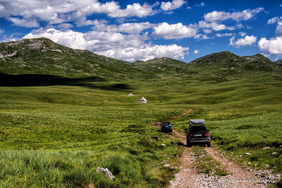
2. TRACK – HIGHLANDS TRAIL COUNTRY – MONTENEGRO DISTANCE -250KM
This trail is suitable for factory standard vehicles though it is advised not to try and tackle this track in a SUV particularly one with low to mediocre ground clearance mainly because of the very rocky terrain. For the same reason tyres with very strong sidewalls (preferably AT class) are mandatory! This track also incorporates an open grassland trail through some very rare forests. It is easy to avoid any risky parts, even in case of rainy weather, however, do not try to drive it too early in the season (before June), because the high altitude nature of the track can often make it impassable because of snow drifts that can be there deep into the spring.
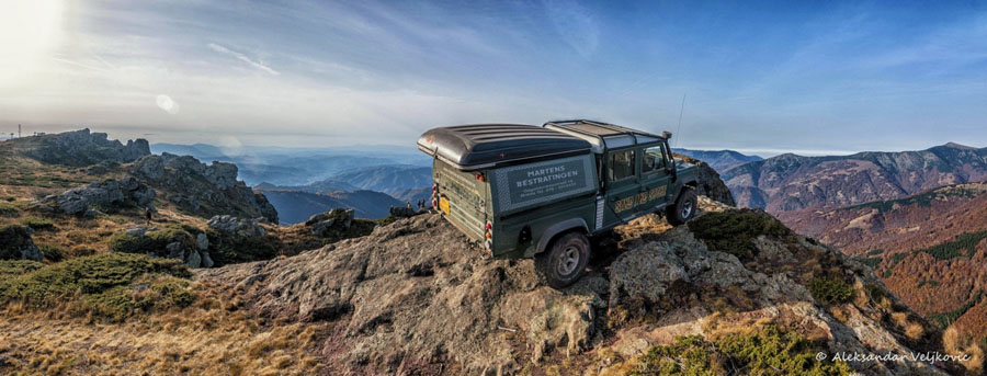
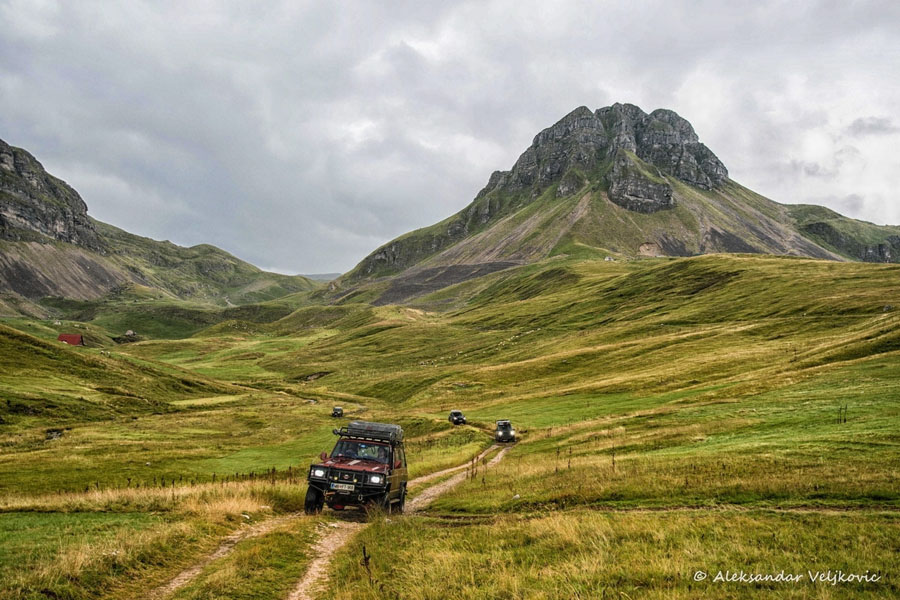 This is probably one of the trails with the highest average altitude in the Balkans, hovering between 1500 and 1900 metres. You will only descend at the very end of the track as it approaches Podgorica, the capital of Montenegro. Most of the very attractive wild camp spots are situated around the altitude of 1700 m (so prepare for cold nights, even in mid-summer!). The track starts at the small town of Zabljak, situated at an altitude of 1450 m in the Durmitor national park in the north of Montenegro, and plunges into Sinjajevina, a huge highland plateau which is probably the largest mountainous highland area of its kind in Europe (about 80 km in diameter). From Sinjajevina it follows the central Montenegrian mountain range southwards, crossing mountains such as Lola, Moraca mountains and Maganik before descending into the sea level valley near Podgorica. This awesome track does not pass through any settlement (either village or town), but you will encounter nomadic shepherd huts where people have preserved the ancient ways of life. It is mostly dirt and gravel track, crossing very short portions of tarmac in two places. In several spots interesting (slightly more technically difficult) shortcuts are possible, but since these are not marked, expert guidance is advised.
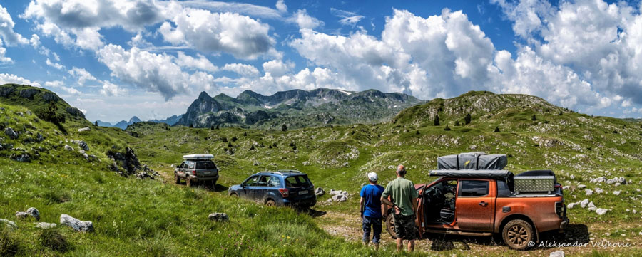
Attractions along the route include numerous mountain lakes. One of them is located near Zabljak at the beginning of the trail (Vrazje and Riblje, meaning Devil’s and Fish lake) Zaboj lake is situated in a beautiful pine forest and some 10 km outside the main trail. Captain’s lake (Kapetanovo jezero) is in the second part of the trail, and is possibly the most attractive lake in Montenegro, often called „the centre of Montenegro“, since it’s geographically in the middle of the country. It’s large, it’s high (1700 m) and features lots of shepherd huts, including two improvised cafes. It’s a great place to take a break. The very rugged landscape, resembling central Asia more than Europe, gives you a special feeling of remoteness and being outside of the known world.
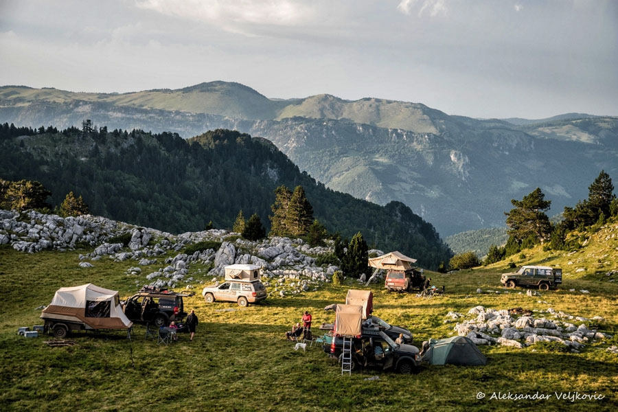
Take note that, along this trail, there are no hotels and no petrol stations either. So be sure to fill up your fuel tanks in Žabljak before you enter Sinjajevina, because your next chance to refuel will be Podgorica, some 250 km away. If you’re ok with some very basic, spartan type of accommodation to make a break from camping, you can get rooms offered by the locals at Captain’s lake (no bathroom, toilet outside).
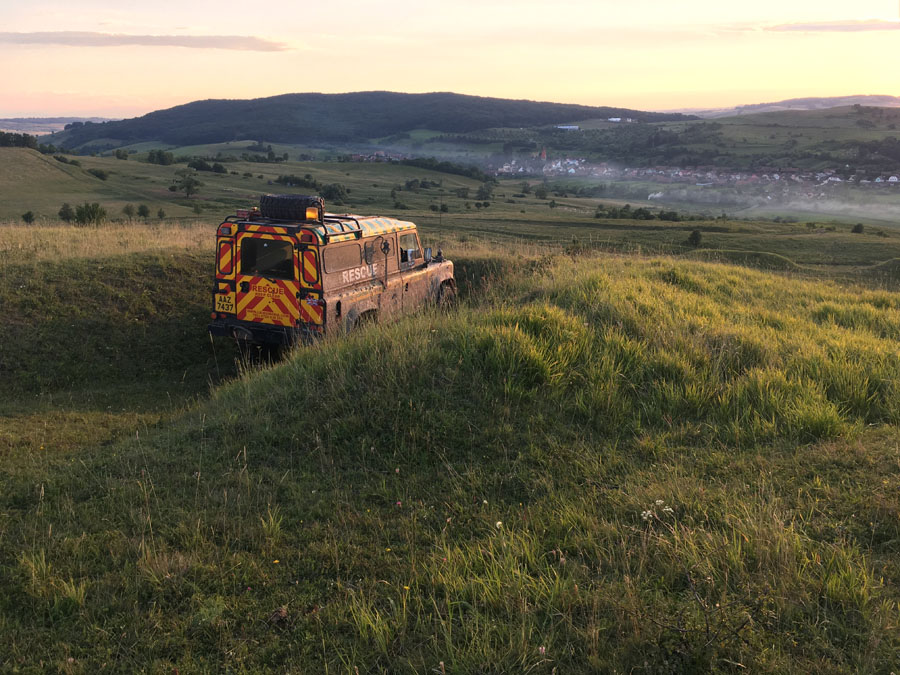
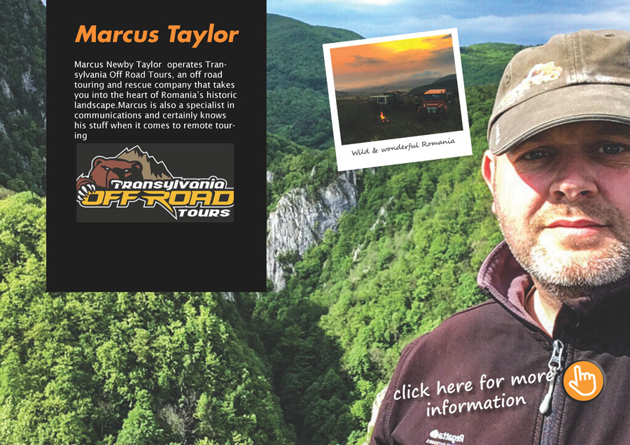
3. TRACK – TRANSFAGARASAN T0 SIGHISOARA COUNTRY – ROMANIA DISTANCE -80KM
We recently caught up with British expat Marcus Newby Taylor who operates Transylvania Off Road Tours, an off road touring and rescue company that takes you into the heart of Romania’s historic landscape. Marcus has kindly given us the lowdown on one of his favourite tracks just off the Transfagarasan highway.
After enjoying the spectacular views on the famous Transfagarasan highway and before tackling this track, you can take a night’s rest at Ana B+B suggested Marcus. This is run by a British expat and his lovely Romanian wife, who offer versatile accommodation for single travellers and families alike with the option for evening and morning meals and even a packed lunch to take with you.
![]()
Setting off in the morning, use google maps to head for Nou Roman, stop off at the Lukoil garage on the junction of 7C (Transfagarasan)/DN1 (E68) to top up any levels and drinks. Once you get to Nou Roman you begin your trek though ancient Saxon villages including what is thought to be the original Saxon settlement in the 13th Century, Sasaus.Keep following the dirt tracks north to Dealu Frumos where you can visit a renovated (but not publicly open) fortified Saxon church. Just email Marcus Taylor at [email protected] a day in advance and he can arrange for you to meet the key holder and gain access to explore the medieval building and its grounds.If you feel like a restaurant lunch, there is a nice place just outside of the village called Pensiunea Elisabeta where you can sample some traditional Romanian staples.
Heading north towards Movile
Keep heading north through Movile, where you can see hundreds of Neolithic mounds dotting the rolling landscape before reaching a nice little rest spot in the shade at 46.10583, 24.8993. From this point follow the forestry road down to the 106 tarmacked road and then go via Apoldo to Vulcan, once again using google maps before rejoining the track and heading up to Sarpatoc where you can find a nice spot to wild camp or move on down the hills into Sighisoara where there is a wide selection of amazing hotels and restaurants as well as beautiful medieval city walks within the old citadel walls.
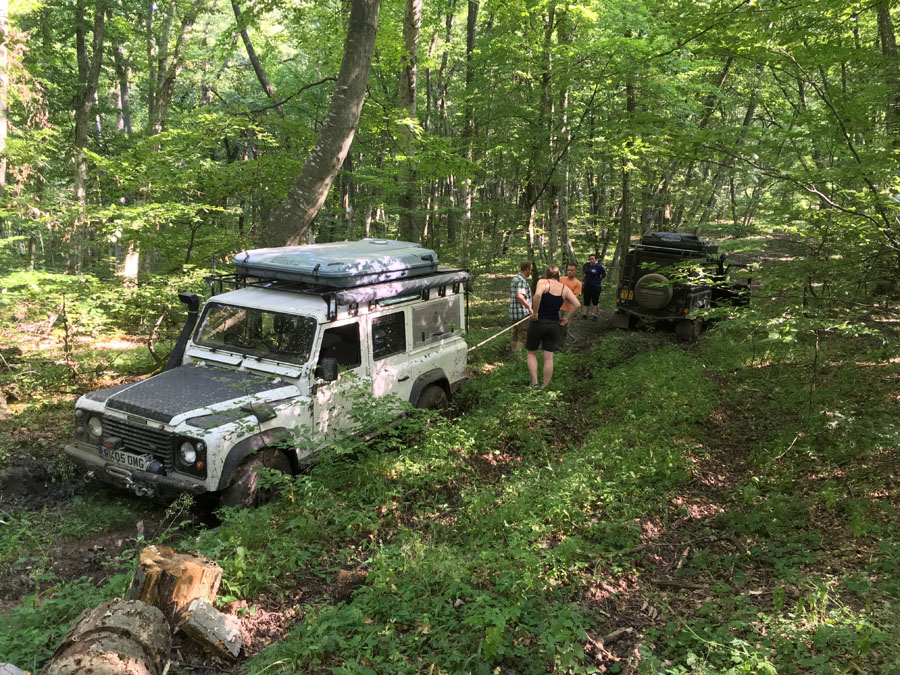
In the dry weather there is little to no challenging offroading, some dusty tracks but a lot of grass where you can enjoy a dust free roaming experience. In wet weather some of the tracks (especially in the forests) can become very boggy very quickly, offering a challenge for even the seasoned offroader. It is advisable to have at least AT tyres and for at least one of the vehicles in the group to be equipped with a winch. Should you find yourself in trouble you can contact Marcus Taylor are Transylvania Offroad who can arrange various kinds of assistance from free recovery (though www.rescue4x4.ro) out of a difficult spot to full recovery to a garage and arrange repairs at a reasonable price.
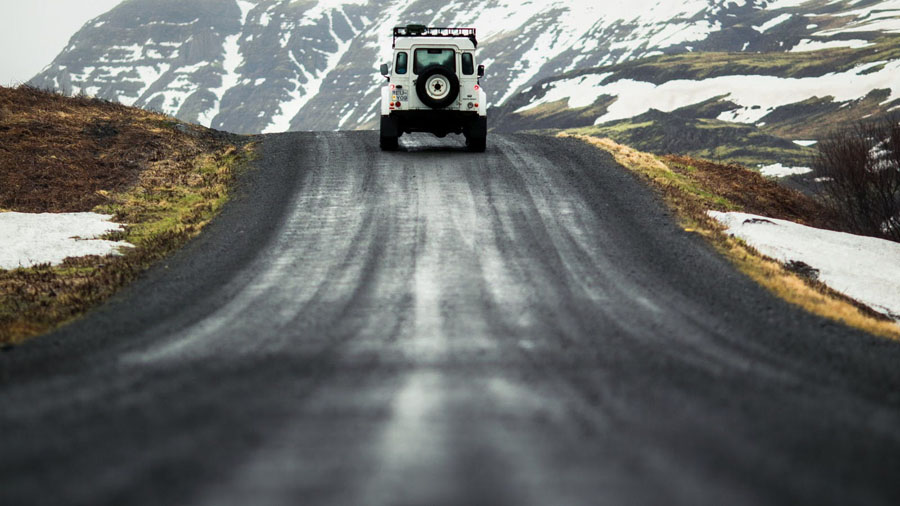
4. TRACK – SPRENGISANDUR COUNTRY – ICELAND DISTANCE -419KM
Iceland is a magnificent place for 4WD touring. The interior of the island is mostly uninhabited, and everywhere you turn there are some amazing, rugged and sometimes desolate vistas. You can drive for hours and never see another vehicle
The Sprengisandur track, in the centre of Iceland takes you right through the highlands, driving between the two mountain glaciers of Hofsjökull and Vatnajökull.
This rough, dirt track brings travellers through a valley between the two giant glaciers and also requires driving through two deep rivers. The Sprengisandur track,is a route with a total distance of only 419km but with an estimated driving time of 13 hours. This duration is due to the corrugated and uneven surface of the track and the requirement to ford several rivers en-route. When travelling this route, it is possible to stop near the middle of the route and to spend the night at a mountain hut which is located directly between the two glaciers 800 meters above sea level at Nyidalur.
Sprengisandur is only accessible during summer – like other parts of the inner desert, it is impassable in winter because of the snow, and in spring because of floods.
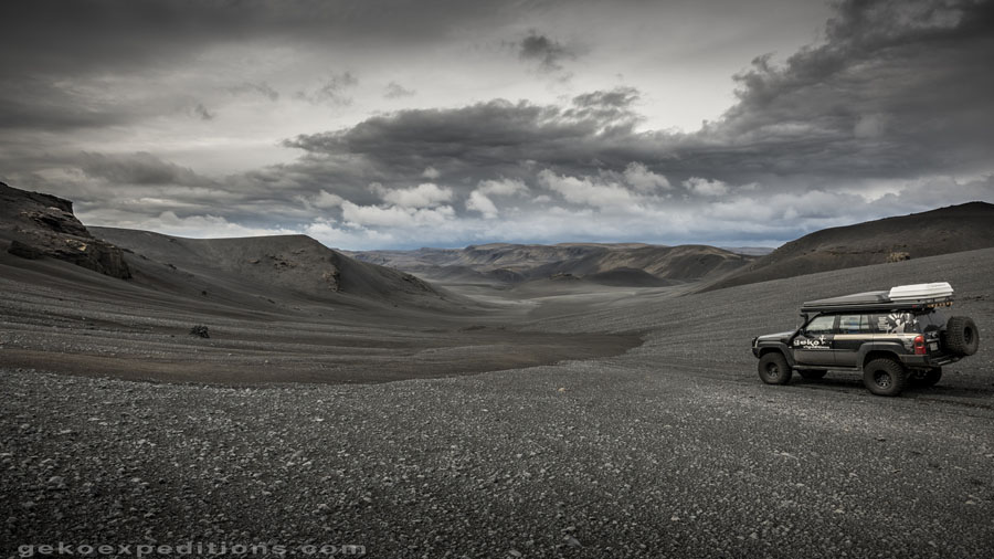
Driving across the Sprengisandur you are presented an utterly alien vista, majestic highland deserts stretching into the distance, lots of strange rock formations and barren landscapes. In addition to the two glaciers you can catch great views of the volcanoes Askja and Herðubreið from the track.
Crossing this track can be challenging driving, the rough corrugated surface of the track can causs a very jarring motion in the vehicles, and the sides of the track are also not always easy to discern, so constant concentration is required in order to prevent accidentally driving off the track.
Having spent the night in Nyidalur, and recovering from the first 7 hours of bumpy driving, the rest of the route as the track descends down from the plateau between the glaciers is equally breathtaking as the first part and equally rugged. Eventually near the east coast, the asphalt road re-appears as you approach the Mývatn area. Mývatn is a shallow lake situated in an area of active volcanism in the north of Iceland, its name (Icelandic mý (“midge”) and vatn (“lake”); the lake of midges) comes from the huge numbers of flies (midges) to be found there in the summer.
5. ROAD TRIP – EN2 ROAD COUNTRY – PORTUGAL DISTANCE -739KM
Portugal has many roads and tracks to appreciate the sheer beauty and diversity of the country, but according to José Almeida one road in particular stands above the rest. The National Road number 2 or simply the EN2 (Estrada Nacional in Portuguese) as it’s known, has a total length of 739.260 Kms (459.355 miles), making it the country’s longest road and one of the longest in the world. The EN2 literally crosses the entire country through the middle connecting the cities of Chaves in the north to Faro in the south edge of the Algarve, just a few hundred yards from the Atlantic ocean.
The road was formally established on May,11th 1945 as a result of an official decree from the government, setting the criteria for the classification of roads under the new National Road Plan. At the time, a big part of its route corresponded to many smaller and older roads, some going as far back as medieval and even roman times.
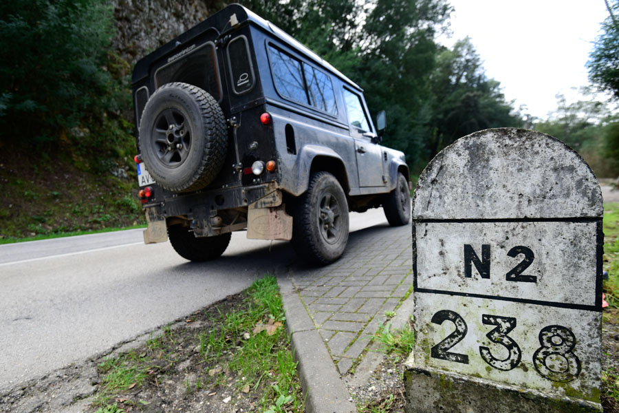
The N2 is 739km long
Over the years the road has suffered several adjustments in terms of layout but in its current format, it crosses 11 districts, 35 counties and 11 cities, not to mention some of the country’s most important rivers and old railways. Driving along the EN2 on the northern half of the country, the traveller will start by appreciating many of Portugal’s mountain ranges, where the road reaches a max altitude of over 1000 mts, offering travellers breathtaking vistas as far as the eye can see.
On the second half of the trip, south of the Tagus river, the landscape and the character of the land is a world apart, with vast undulating plains and endless fields of cork and olive trees on both sides of the road. The architecture, cuisine and traditions of the south of Portugal is still marked by the influences left by the Arabs during their stay in the Iberian Peninsula for five centuries. On the last section, the road has one of the most winding sections across the mountains of the inner Algarve, before reaching the sunny sea shore of the Algarve.
To really appreciate the experience of driving the EN2, at least 5 to 7 days should be allowed to give you enough time to experience the local culture, savour the cuisine, visit the most important places of interest, and most importantly interact with the locals along the way.

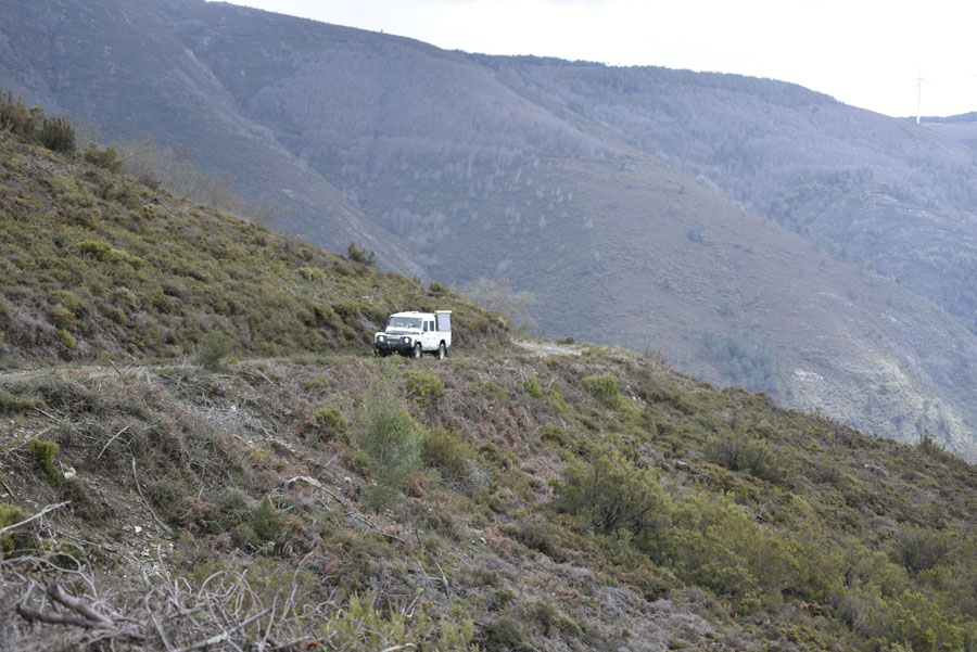
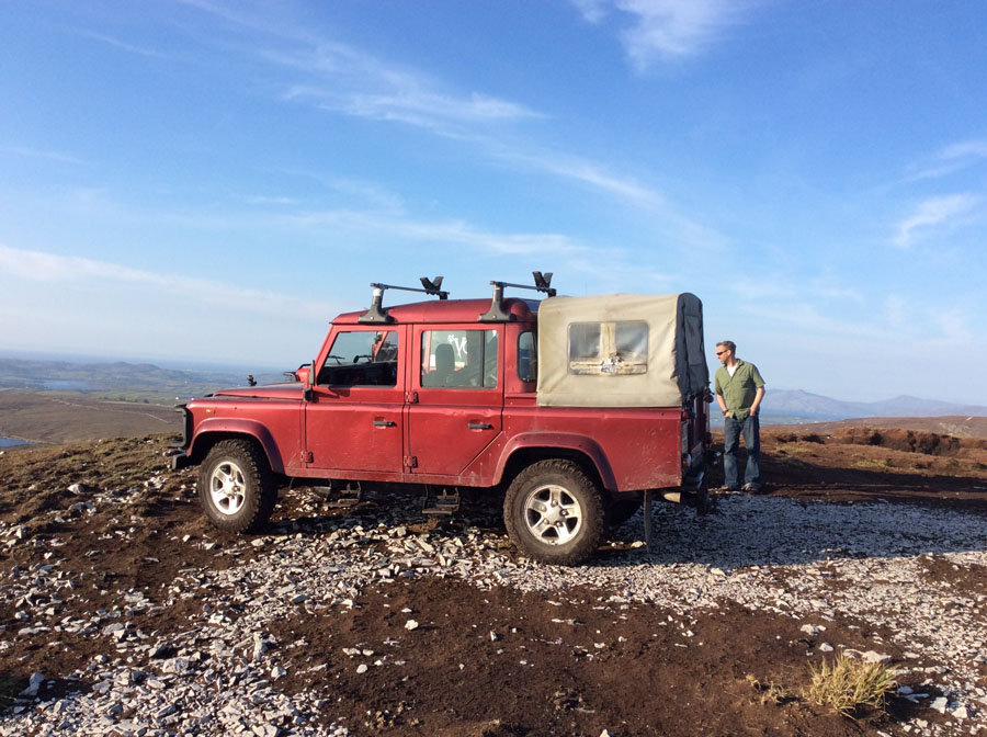
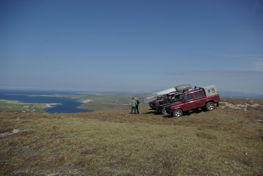
6. TRACK – DONEGAL – WILD ATLANTIC WAY COUNTRY – IRELAND DISTANCE – VARIES
One of the counties along the Wild Atlantic Way route, that offers some exceptional 4WD tracks to explore is County Donegal. Donegal located in the North West, is one of largest counties in Ireland at 85 miles long and 41 miles wide with many islands. It covers an area of 1.2 million acres (c.500,000 hectares). Two thirds of the land consists of rough pasture and upland bog between 600 and 2000 feet above sea level. You won’t be disappointed.
Donegal is famous for its rugged mountains and rough pasture that cover seventy percent of the county with remote tracks that meander through a staggering 1.2 million acres or five hundred hectares of remote land. This stunning part of Ireland with its lake-filled valleys, unpolluted seas, vertical sea cliffs, expansive windswept moorland, craggy coastline, sandy beaches, is an ideal wilderness for exploring in your 4WD.
The scenery in Donegal is amazing
If you have not heard about this coastal adventure yet, you probably will soon, as the Irish Tourism Department is actively promoting this touring gem to the rest of the world, simply called The Wild Atlantic Way.Taking in the remote tracks along entire west coast of Ireland, it starts from the picturesque town of Kinsale in County Cork and goes through counties Kerry, Clare, Galway, Mayo, Sligo, Leitrim before ending in County Donegal. Alternatively, you can start in Donegal and work your way down the coast to Kinsale.
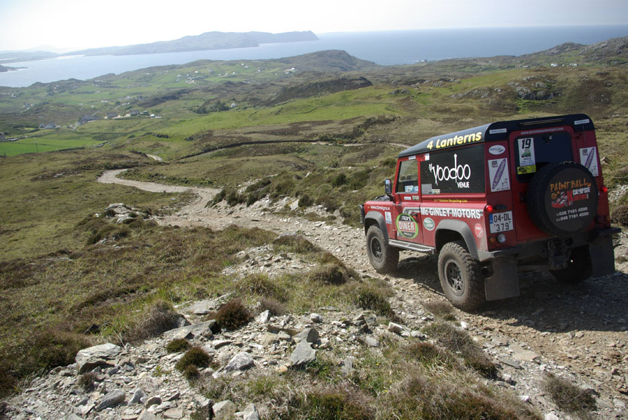
This is a remote part of Ireland with plenty of 4WD tracks to explore
Recent Comments