
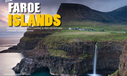
Touring Cape York – An Australian Adventure.
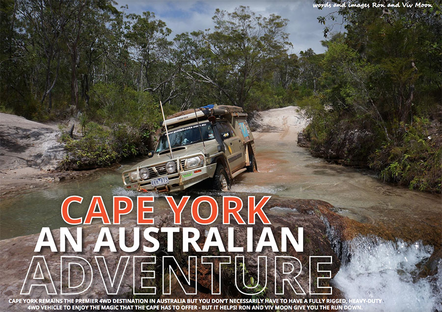
Cape York remains the premier 4WD destination in Australia but you don’t necessarily have to have a fully rigged, heavy-duty 4WD vehicle to enjoy the magic that the Cape has to offer – but it helps! Ron and Viv Moon give you the run down.
Normanby River
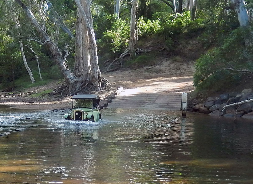
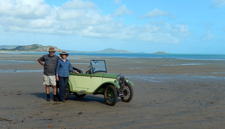
When Bev and Lang Kidby drove their 1928 Austin 7, ‘Daisy’, onto the beach at Punsand Bay near the top of Cape York in June a couple of years back, they weren’t doing anything new. In fact, they were recreating, as much as possible in this day and age, the first motorised vehicle trip to Cape York. Two New Zealanders, Hector MacQuarrie and Dick Mathews, completed that original adventure in an Austin 7 in 1928, and their gripping yarn was subsequently told in the book, We and the Baby.
At The Tip
If anything, Lang and Bev’s recent escapade (they are arguably Australia’s greatest adventurers by aircraft, motorbike and motor vehicle, old and new – see: www.next-horizon.org) reinforces the fact that you don’t need a heavy-duty 4WD vehicle to travel to Cape York. Now more than ever the route is open to any SUV or light-duty 4WD on the market, although a fully kitted out 4WD will get you into a plethora of places that lie off the major dirt roads in the region, or help you get through when dirt roads turn to slippery mud. Still, for the most part, from early June to the end of September, the Cape is open to most people who are willing to get a bit of dust on the duco, or a chip in their windscreen.
For first-time visitors to the Cape the trip normally begins around the tourist enclaves of Cairns and Port Douglas, as they climb the range through lush rainforest and head inland across the picturesque Atherton Tablelands to Mt Molloy and Mt Carbine. At this point the tourist numbers start dropping and travellers become more independent and just a little more dusty.
Once at the small enclave of Lakeland, with its rich farming land, you can swing north-west on the Peninsula Developmental Road (PDR), but we’d suggest you continue on the blacktop to historic Cooktown, stopping off to enjoy one of the most iconic and historic pubs of the north, the Lions Den Hotel at Helensvale.
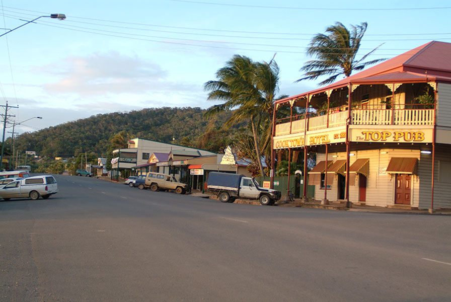
The Queen of the North, as Cooktown is often referred to, sits on the banks of the Endeavour River on the lee side of a wide headland dominated by the rounded dome of Grassy Hill. Captain James Cook, on his ‘discovery’ of the east coast of Australia in 1770, beached and repaired his ship, the Endeavour, here on the south bank of the stream, then sailed away leaving behind an Aboriginal population nonplussed by their sudden arrival and equally sudden departure.
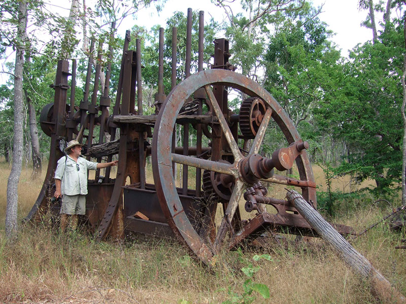
Over 100 years later, when gold was discovered on the remote Palmer River, the port of Cooktown suddenly sprang into existence as the closest and easiest access point to these remote but fabulously rich alluvial goldfields. By the end of 1874 there were around 36 licensed ‘hotels’ and grog shops and more than a hundred brothels in Cooktown, and it was a wild town to say the least.
By the beginning of the 20th Century the town’s population was over 35,000, but competition from other ports further south along the coast, and a few major cyclones and the odd fire along the main thoroughfare of Charlotte Street saw the town decline. Most residents were evacuated during WW2 and another cyclone in 1949 devastated what was left and sent more people packing. Almost a ghost town in the 1950s, tourism began to make its mark, and by 2006 the bitumen was pushed through ensuring a steady supply of tourists and ‘grey nomads’ to keep ‘the Queen’ alive and even thriving.
From Cooktown take the Battle Camp Road, which in the Dry season is suitable for an AWD vehicle driven with care. This route takes you out past Endeavour Falls and Isabella Falls, to crossings of the Normanby and Laura Rivers, the only tricky spots along the whole route. Once on the western bank of the Laura you’ll find the historic and well-preserved Old Laura Homestead, which is worth a stopover.
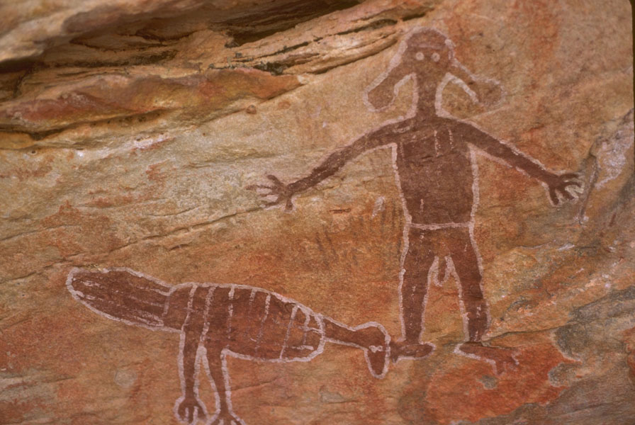
A road junction nearby means you can turn south to the township of Laura for supplies and or repairs. This small town has an impressive Quinkan & Regional Cultural Centre and is the heart of ‘Quinkan Country’, where a visit to the impressive Aboriginal rock art galleries that hide in the escarpment country around the town is a ‘must do’. Of course, there is also a pub in town, and the traditional Laura Dance Festival is held every odd year, with June 2019 being the next great gathering of Aboriginal and Torres Strait people from across the Cape.
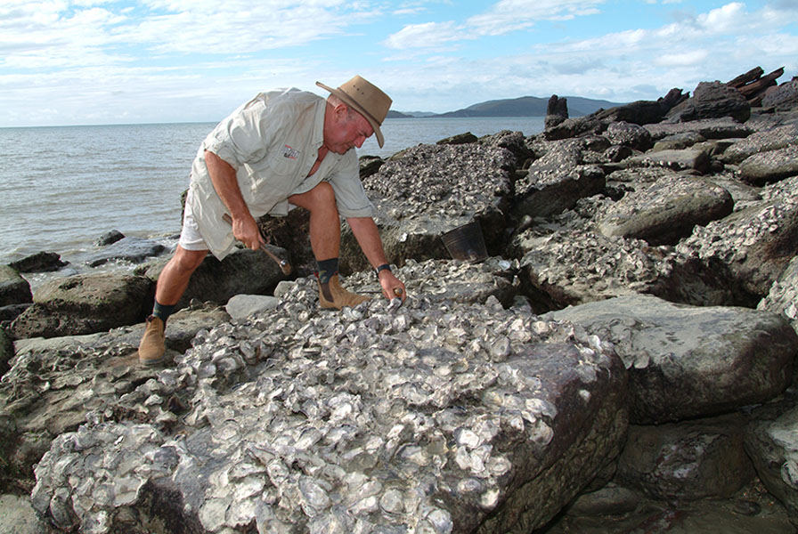
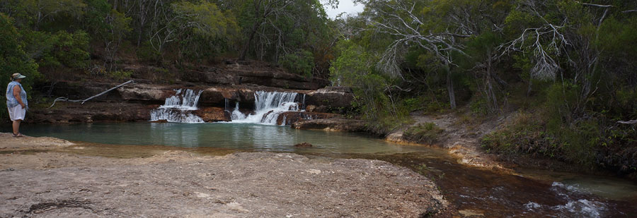
Turning right, back near the Old Laura Homestead, will take you through the heart of Lakefield National Park, the second biggest park in Queensland and offering an overabundance of birdlife, kangaroos, and crocodiles. A number of designated camping areas in the park handle the influx of Dry Season visitors, many of who come for the incredible fishing. Take your time wandering through here, the roads may be dusty, but the camping is well worth it. Our favourite camp is at the Hann Crossing at the rock shelf of the Hann River, while bird lovers will be enthralled by the passing parade at nearby Low Lake or Sweatwater Lake.
From here the route north leaves the park and meets with the PDR just south of the historic Musgrave Roadhouse, once one of the important repeater stations on the Overland Telegraph Line that stretched all the way from Cooktown to the northern tip of the country. Everybody stops here, even if it is just for a cool drink and a browse of the old newspaper cuttings and the like. If you’re there on a Thursday watch out for the mail plane which will buzz the strip to clear it of cattle, kangaroos and wayward tourists, before landing right out the front of the roadhouse.
Coen, the next stop on the PDR north, is the biggest town you’ll pass through without going into Weipa and owes it existence to the discovery of gold near here in 1876. The town boomed in 1893 after the Great Northern Gold Mine opened. There’s a great little museum here now, the pub – officially the Exchange Hotel, often renamed by some wags as the ‘Sexchange Hotel’ – is a beauty to enjoy a cold one, while there is pleasant bush camping a few kilometres north of town, just off the road along the sandy banks of the Coen River.
North of Coen the Oyala Thumotang National Park straddles the PDR, with an access track leading to 15 designated campsites scattered along the rivers that make up this diverse and exciting park. Fishing is allowed in most of the streams, while the birdlife and animal life is amazing.
The Archer River and its attendant roadhouse with its famous burgers and pleasant campground is the next stopping spot along the main route north. For those heading into the verdant rainforest of Iron Range; the unconventional, even eccentric, community of Portland Roads; or the fabulous camping tucked in amongst the trees of the Chili Beach camping area, the Archer River roadhouse is the last resupply point.
Bypassing the Iron Range road and sticking to the PDR soon brings you to a major road junction, where you can swing westward to the mining colossus of Weipa; not that the town is big, but the mining area and the amount of bauxite that is shipped from here is huge. Weipa with its major infrastructure and pleasant campground makes a good base for exploring further afield, especially the mouth of the Pennefather River, the mighty Wenlock River, or the beautiful remote coast in the Aboriginal Shire of Mapoon.
Turning right at the major road junction above – opposite the entry to the Australian Wildlife Conservancy property of Piccaninny Plains (sadly not open to the general public) – will take you onto the main track – the only route – north.
Once you have crossed the Wenlock River on its low bridge you will come to the entry to the old Moreton Telegraph Station with its camping, accommodation and basic supplies. Further north is the entry track to the Steve Irwin Wildlife Reserve (closed to the public) before you arrive at the Bramwell Junction Roadhouse and the nearby Bramwell Station Tourist Park, both with a range of pleasant and enjoyable tourist facilities.
This is decision time!
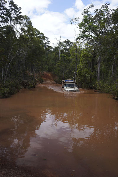
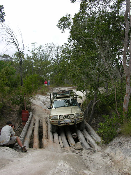
The easiest way north to the top of Cape York is to take the Bypass Roads from Bramwell Junction to the ferry across the wide and delightful Jardine River. But it is not the best way; I always tell people to go at least one way on their Cape York adventure, via the Old Telegraph Line (OTL) Track – but you’ll require a ‘real’ 4WD with low range and high clearance for the OTL!
If you use the Bypass Roads (Southern and Northern Bypass) – so named because they bypass all the creek and river crossings on the OTL track between here and the Jardine – you do have a choice of coming into the OTL track at a number of points generally close to where the OTL track crosses a creek or river. But it is a longer (and more boring) alternative and not as enjoyable or as challenging as driving the OTL track.
So, once on the OTL Track north from Bramwell, you begin to cross a number of streams, starting with Palm Creek, then in quick succession, the South Alice and North Alice before coming to the beautiful Dulhunty River crossing. Bertie Creek and Cholmondeley Creek follow with the intimidating Gunshot Creek next. This can be bypassed and most sensible people do so. Then it’s onto Cockatoo and Sailor Creeks before the original route north is joined by the Southern Bypass Road.
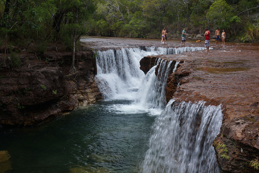
The Northern Bypass road swings away to the west near the track junction that can take you east a short distance to the popular swimming point of Fruit Bat Falls on the Eliot Creek, while the OTL Track continues to head north. Scrubby Creek is then next and can be deep, and you’ll then come to the access to Eliot Falls camping area and one spot you shouldn’t miss. Nearby are Twin Falls on Canal Creek and 50 metres away, Indian Head Falls on Eliot Creek. It is a terrific spot!
North of the camping area you quickly come to some challenging crossings – Canal Creek, then Sam, Mistake, Cannibal and the deceptively easy looking Cypress Creek, which claims many radiators and engines each year with people taking the wrong line or driving in too fast.
Soon after you are in the heart of the Jardine Swamps that border the mighty river of the same name. You can camp on the southern bank of the river near where the OTL once crossed the river in near complete isolation – few people come here. Some still cross the stream though, but it is a mighty challenge, not the least being the deep, dark lily covered water along the north bank where crocodiles often lurk.
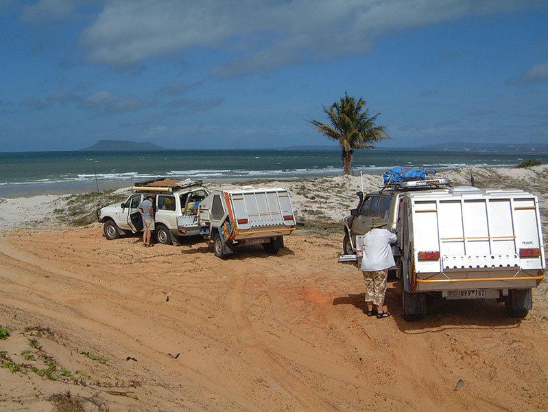
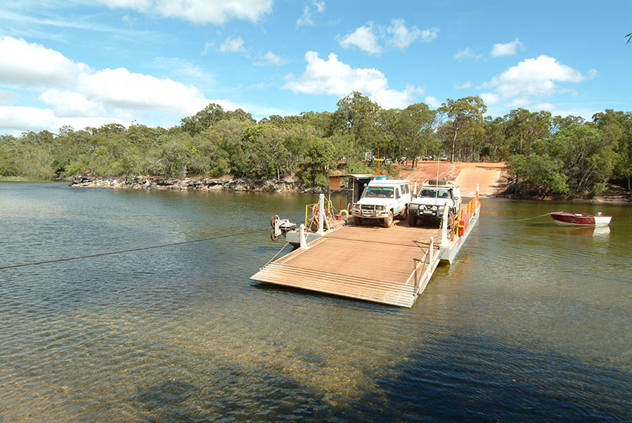
For most travellers the ferry across the Jardine a little further west and the northern terminus of the Northern Bypass Road offers an easy, safe alternative and once on the north bank it is an undemanding drive to the Torres Strait Islander communities of Bamaga and Seisia. There’s a choice of community owned camping areas to stay at north of the Jardine River and a few bush camps covered by the Ferry fee.
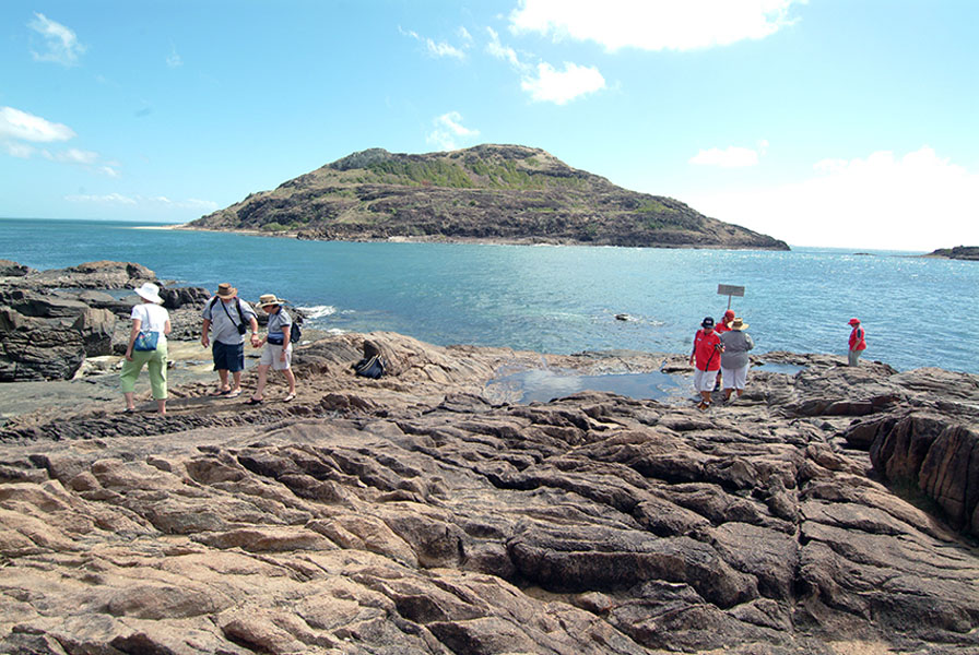
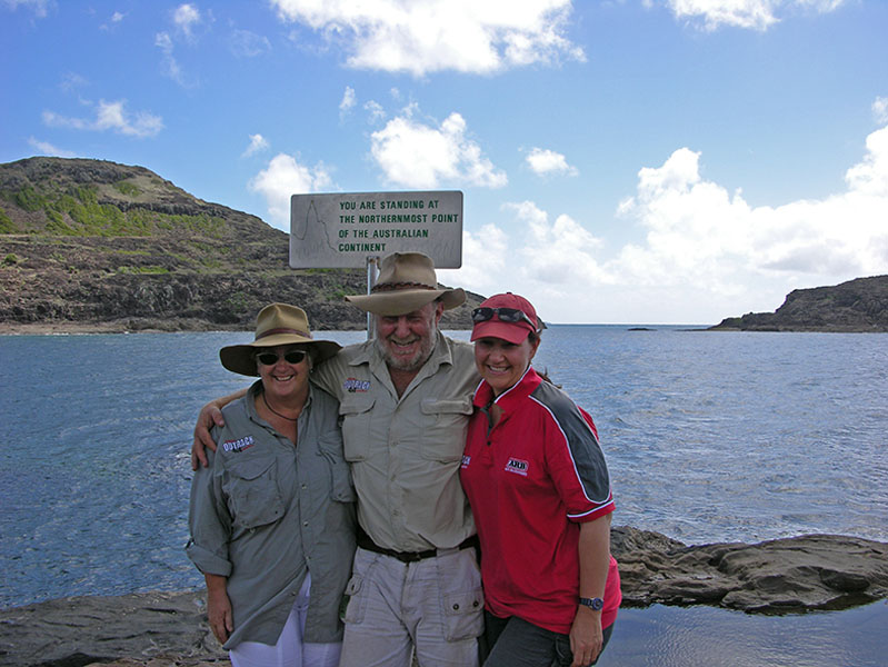
Of course, the journey hasn’t been completed until you drive the 32km from Bamaga and take the walk through the rainforest, across the bluff and down to the rocky tip that makes up the northernmost point of the Australian mainland while the dome shaped islands of Torres Strait dot the azure blue waters in front of you. You’ve made it!
While in the area take in the delightful beach at Somerset and the historic home site and gardens of Frank Jardine and his family who lived here from the 1860s till WW2 saw them being evacuated south. They never returned.
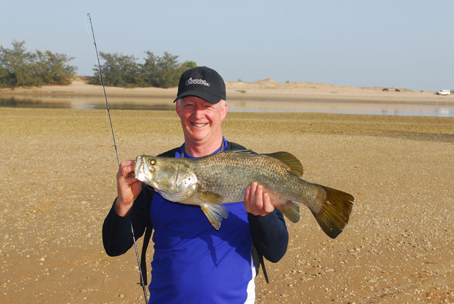
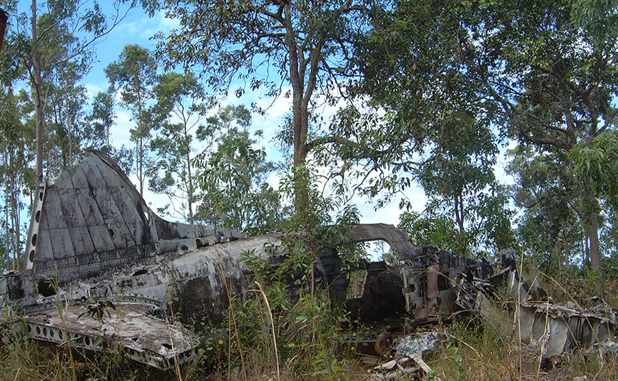
Another not-to-miss excursion while north of the Jardine is to Thursday Island and nearby Horn Island. You’ll be pleasantly surprised by the multi-cultural ambience and history of TI, as Thursday island is mainly known, and the WW2 history of Horn Island that saw it bombed by the Japanese a number of times. For pearl lovers a visit to Roko Island pearl farm is enlightening (there’s tented accommodation here as well). Fishermen can do battle with a choice of thrilling fresh water adversaries or even bigger salt water rivals, while the jetty at Seisa – or Red Island Point to be more correct – would have to be one of the best land-based fishing spots in all of Australia!
What more could you ask for as a holiday destination for an adventurous traveller? Cape York dishes it up … in spades.
About the Authors
Ron and Viv Moon have travelled to Cape York around 40 times over the last 37 years and have written a guidebook on the region for 32 years. They travel widely in Australia and overseas by vehicle each year. For more information go to: www.guidebooks.com.au, and:
or visit their Facebook page at:
Touring Cape York – An Australian Adventure.

Recent Comments